Get trending papers in your email inbox once a day!
Get trending papers in your email inbox!
Subscribe
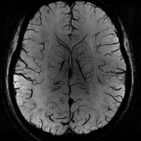
A co-evolving agentic AI system for medical imaging analysis
Agentic AI is rapidly advancing in healthcare and biomedical research. However, in medical image analysis, their performance and adoption remain limited due to the lack of a robust ecosystem, insufficient toolsets, and the absence of real-time interactive expert feedback. Here we present "TissueLab", a co-evolving agentic AI system that allows researchers to ask direct questions, automatically plan and generate explainable workflows, and conduct real-time analyses where experts can visualize intermediate results and refine them. TissueLab integrates tool factories across pathology, radiology, and spatial omics domains. By standardizing inputs, outputs, and capabilities of diverse tools, the system determines when and how to invoke them to address research and clinical questions. Across diverse tasks with clinically meaningful quantifications that inform staging, prognosis, and treatment planning, TissueLab achieves state-of-the-art performance compared with end-to-end vision-language models (VLMs) and other agentic AI systems such as GPT-5. Moreover, TissueLab continuously learns from clinicians, evolving toward improved classifiers and more effective decision strategies. With active learning, it delivers accurate results in unseen disease contexts within minutes, without requiring massive datasets or prolonged retraining. Released as a sustainable open-source ecosystem, TissueLab aims to accelerate computational research and translational adoption in medical imaging while establishing a foundation for the next generation of medical AI.
HEST-1k: A Dataset for Spatial Transcriptomics and Histology Image Analysis
Spatial transcriptomics (ST) enables interrogating the molecular composition of tissue with ever-increasing resolution, depth, and sensitivity. However, costs, rapidly evolving technology, and lack of standards have constrained computational methods in ST to narrow tasks and small cohorts. In addition, the underlying tissue morphology as reflected by H&E-stained whole slide images (WSIs) encodes rich information often overlooked in ST studies. Here, we introduce HEST-1k, a collection of 1,108 spatial transcriptomic profiles, each linked to a WSI and metadata. HEST-1k was assembled using HEST-Library from 131 public and internal cohorts encompassing 25 organs, two species (Homo Sapiens and Mus Musculus), and 320 cancer samples from 25 cancer types. HEST-1k processing enabled the identification of 1.5 million expression--morphology pairs and 60 million nuclei. HEST-1k is tested on three use cases: (1) benchmarking foundation models for histopathology (HEST-Benchmark), (2) biomarker identification, and (3) multimodal representation learning. HEST-1k, HEST-Library, and HEST-Benchmark can be freely accessed via https://github.com/mahmoodlab/hest.

SToFM: a Multi-scale Foundation Model for Spatial Transcriptomics
Spatial Transcriptomics (ST) technologies provide biologists with rich insights into single-cell biology by preserving spatial context of cells. Building foundational models for ST can significantly enhance the analysis of vast and complex data sources, unlocking new perspectives on the intricacies of biological tissues. However, modeling ST data is inherently challenging due to the need to extract multi-scale information from tissue slices containing vast numbers of cells. This process requires integrating macro-scale tissue morphology, micro-scale cellular microenvironment, and gene-scale gene expression profile. To address this challenge, we propose SToFM, a multi-scale Spatial Transcriptomics Foundation Model. SToFM first performs multi-scale information extraction on each ST slice, to construct a set of ST sub-slices that aggregate macro-, micro- and gene-scale information. Then an SE(2) Transformer is used to obtain high-quality cell representations from the sub-slices. Additionally, we construct SToCorpus-88M, the largest high-resolution spatial transcriptomics corpus for pretraining. SToFM achieves outstanding performance on a variety of downstream tasks, such as tissue region semantic segmentation and cell type annotation, demonstrating its comprehensive understanding of ST data through capturing and integrating multi-scale information.
SGUQ: Staged Graph Convolution Neural Network for Alzheimer's Disease Diagnosis using Multi-Omics Data
Alzheimer's disease (AD) is a chronic neurodegenerative disorder and the leading cause of dementia, significantly impacting cost, mortality, and burden worldwide. The advent of high-throughput omics technologies, such as genomics, transcriptomics, proteomics, and epigenomics, has revolutionized the molecular understanding of AD. Conventional AI approaches typically require the completion of all omics data at the outset to achieve optimal AD diagnosis, which are inefficient and may be unnecessary. To reduce the clinical cost and improve the accuracy of AD diagnosis using multi-omics data, we propose a novel staged graph convolutional network with uncertainty quantification (SGUQ). SGUQ begins with mRNA and progressively incorporates DNA methylation and miRNA data only when necessary, reducing overall costs and exposure to harmful tests. Experimental results indicate that 46.23% of the samples can be reliably predicted using only single-modal omics data (mRNA), while an additional 16.04% of the samples can achieve reliable predictions when combining two omics data types (mRNA + DNA methylation). In addition, the proposed staged SGUQ achieved an accuracy of 0.858 on ROSMAP dataset, which outperformed existing methods significantly. The proposed SGUQ can not only be applied to AD diagnosis using multi-omics data but also has the potential for clinical decision-making using multi-viewed data. Our implementation is publicly available at https://github.com/chenzhao2023/multiomicsuncertainty.
Explainable AI Methods for Multi-Omics Analysis: A Survey
Advancements in high-throughput technologies have led to a shift from traditional hypothesis-driven methodologies to data-driven approaches. Multi-omics refers to the integrative analysis of data derived from multiple 'omes', such as genomics, proteomics, transcriptomics, metabolomics, and microbiomics. This approach enables a comprehensive understanding of biological systems by capturing different layers of biological information. Deep learning methods are increasingly utilized to integrate multi-omics data, offering insights into molecular interactions and enhancing research into complex diseases. However, these models, with their numerous interconnected layers and nonlinear relationships, often function as black boxes, lacking transparency in decision-making processes. To overcome this challenge, explainable artificial intelligence (xAI) methods are crucial for creating transparent models that allow clinicians to interpret and work with complex data more effectively. This review explores how xAI can improve the interpretability of deep learning models in multi-omics research, highlighting its potential to provide clinicians with clear insights, thereby facilitating the effective application of such models in clinical settings.
Spatial Computing: Concept, Applications, Challenges and Future Directions
Spatial computing is a technological advancement that facilitates the seamless integration of devices into the physical environment, resulting in a more natural and intuitive digital world user experience. Spatial computing has the potential to become a significant advancement in the field of computing. From GPS and location-based services to healthcare, spatial computing technologies have influenced and improved our interactions with the digital world. The use of spatial computing in creating interactive digital environments has become increasingly popular and effective. This is explained by its increasing significance among researchers and industrial organisations, which motivated us to conduct this review. This review provides a detailed overview of spatial computing, including its enabling technologies and its impact on various applications. Projects related to spatial computing are also discussed. In this review, we also explored the potential challenges and limitations of spatial computing. Furthermore, we discuss potential solutions and future directions. Overall, this paper aims to provide a comprehensive understanding of spatial computing, its enabling technologies, their impact on various applications, emerging challenges, and potential solutions.


SpaRC and SpaRP: Spatial Reasoning Characterization and Path Generation for Understanding Spatial Reasoning Capability of Large Language Models
Spatial reasoning is a crucial component of both biological and artificial intelligence. In this work, we present a comprehensive study of the capability of current state-of-the-art large language models (LLMs) on spatial reasoning. To support our study, we created and contribute a novel Spatial Reasoning Characterization (SpaRC) framework and Spatial Reasoning Paths (SpaRP) datasets, to enable an in-depth understanding of the spatial relations and compositions as well as the usefulness of spatial reasoning chains. We found that all the state-of-the-art LLMs do not perform well on the datasets -- their performances are consistently low across different setups. The spatial reasoning capability improves substantially as model sizes scale up. Finetuning both large language models (e.g., Llama-2-70B) and smaller ones (e.g., Llama-2-13B) can significantly improve their F1-scores by 7--32 absolute points. We also found that the top proprietary LLMs still significantly outperform their open-source counterparts in topological spatial understanding and reasoning.
SpaCE: The Spatial Confounding Environment
Spatial confounding poses a significant challenge in scientific studies involving spatial data, where unobserved spatial variables can influence both treatment and outcome, possibly leading to spurious associations. To address this problem, we introduce SpaCE: The Spatial Confounding Environment, the first toolkit to provide realistic benchmark datasets and tools for systematically evaluating causal inference methods designed to alleviate spatial confounding. Each dataset includes training data, true counterfactuals, a spatial graph with coordinates, and smoothness and confounding scores characterizing the effect of a missing spatial confounder. It also includes realistic semi-synthetic outcomes and counterfactuals, generated using state-of-the-art machine learning ensembles, following best practices for causal inference benchmarks. The datasets cover real treatment and covariates from diverse domains, including climate, health and social sciences. SpaCE facilitates an automated end-to-end pipeline, simplifying data loading, experimental setup, and evaluating machine learning and causal inference models. The SpaCE project provides several dozens of datasets of diverse sizes and spatial complexity. It is publicly available as a Python package, encouraging community feedback and contributions.
OmniGeo: Towards a Multimodal Large Language Models for Geospatial Artificial Intelligence
The rapid advancement of multimodal large language models (LLMs) has opened new frontiers in artificial intelligence, enabling the integration of diverse large-scale data types such as text, images, and spatial information. In this paper, we explore the potential of multimodal LLMs (MLLM) for geospatial artificial intelligence (GeoAI), a field that leverages spatial data to address challenges in domains including Geospatial Semantics, Health Geography, Urban Geography, Urban Perception, and Remote Sensing. We propose a MLLM (OmniGeo) tailored to geospatial applications, capable of processing and analyzing heterogeneous data sources, including satellite imagery, geospatial metadata, and textual descriptions. By combining the strengths of natural language understanding and spatial reasoning, our model enhances the ability of instruction following and the accuracy of GeoAI systems. Results demonstrate that our model outperforms task-specific models and existing LLMs on diverse geospatial tasks, effectively addressing the multimodality nature while achieving competitive results on the zero-shot geospatial tasks. Our code will be released after publication.
A Large-Scale Benchmark of Cross-Modal Learning for Histology and Gene Expression in Spatial Transcriptomics
Spatial transcriptomics enables simultaneous measurement of gene expression and tissue morphology, offering unprecedented insights into cellular organization and disease mechanisms. However, the field lacks comprehensive benchmarks for evaluating multimodal learning methods that leverage both histology images and gene expression data. Here, we present HESCAPE, a large-scale benchmark for cross-modal contrastive pretraining in spatial transcriptomics, built on a curated pan-organ dataset spanning 6 different gene panels and 54 donors. We systematically evaluated state-of-the-art image and gene expression encoders across multiple pretraining strategies and assessed their effectiveness on two downstream tasks: gene mutation classification and gene expression prediction. Our benchmark demonstrates that gene expression encoders are the primary determinant of strong representational alignment, and that gene models pretrained on spatial transcriptomics data outperform both those trained without spatial data and simple baseline approaches. However, downstream task evaluation reveals a striking contradiction: while contrastive pretraining consistently improves gene mutation classification performance, it degrades direct gene expression prediction compared to baseline encoders trained without cross-modal objectives. We identify batch effects as a key factor that interferes with effective cross-modal alignment. Our findings highlight the critical need for batch-robust multimodal learning approaches in spatial transcriptomics. To accelerate progress in this direction, we release HESCAPE, providing standardized datasets, evaluation protocols, and benchmarking tools for the community
SeNMo: A Self-Normalizing Deep Learning Model for Enhanced Multi-Omics Data Analysis in Oncology
Multi-omics research has enhanced our understanding of cancer heterogeneity and progression. Investigating molecular data through multi-omics approaches is crucial for unraveling the complex biological mechanisms underlying cancer, thereby enabling effective diagnosis, treatment, and prevention strategies. However, predicting patient outcomes through integration of all available multi-omics data is an under-study research direction. Here, we present SeNMo (Self-normalizing Network for Multi-omics), a deep neural network trained on multi-omics data across 33 cancer types. SeNMo is efficient in handling multi-omics data characterized by high-width (many features) and low-length (fewer samples) attributes. We trained SeNMo for the task of overall survival using pan-cancer data involving 33 cancer sites from Genomics Data Commons (GDC). The training data includes gene expression, DNA methylation, miRNA expression, DNA mutations, protein expression modalities, and clinical data. We evaluated the model's performance in predicting overall survival using concordance index (C-Index). SeNMo performed consistently well in training regime, with the validation C-Index of 0.76 on GDC's public data. In the testing regime, SeNMo performed with a C-Index of 0.758 on a held-out test set. The model showed an average accuracy of 99.8% on the task of classifying the primary cancer type on the pan-cancer test cohort. SeNMo proved to be a mini-foundation model for multi-omics oncology data because it demonstrated robust performance, and adaptability not only across molecular data types but also on the classification task of predicting the primary cancer type of patients. SeNMo can be further scaled to any cancer site and molecular data type. We believe SeNMo and similar models are poised to transform the oncology landscape, offering hope for more effective, efficient, and patient-centric cancer care.


SITE: towards Spatial Intelligence Thorough Evaluation
Spatial intelligence (SI) represents a cognitive ability encompassing the visualization, manipulation, and reasoning about spatial relationships, underpinning disciplines from neuroscience to robotics. We introduce SITE, a benchmark dataset towards SI Thorough Evaluation in a standardized format of multi-choice visual question-answering, designed to assess large vision-language models' spatial intelligence across diverse visual modalities (single-image, multi-image, and video) and SI factors (figural to environmental scales, spatial visualization and orientation, intrinsic and extrinsic, static and dynamic). Our approach to curating the benchmark combines a bottom-up survey about 31 existing datasets and a top-down strategy drawing upon three classification systems in cognitive science, which prompt us to design two novel types of tasks about view-taking and dynamic scenes. Extensive experiments reveal that leading models fall behind human experts especially in spatial orientation, a fundamental SI factor. Moreover, we demonstrate a positive correlation between a model's spatial reasoning proficiency and its performance on an embodied AI task.

Can Multimodal Large Language Models Understand Spatial Relations?
Spatial relation reasoning is a crucial task for multimodal large language models (MLLMs) to understand the objective world. However, current benchmarks have issues like relying on bounding boxes, ignoring perspective substitutions, or allowing questions to be answered using only the model's prior knowledge without image understanding. To address these issues, we introduce SpatialMQA, a human-annotated spatial relation reasoning benchmark based on COCO2017, which enables MLLMs to focus more on understanding images in the objective world. To ensure data quality, we design a well-tailored annotation procedure, resulting in SpatialMQA consisting of 5,392 samples. Based on this benchmark, a series of closed- and open-source MLLMs are implemented and the results indicate that the current state-of-the-art MLLM achieves only 48.14% accuracy, far below the human-level accuracy of 98.40%. Extensive experimental analyses are also conducted, suggesting the future research directions. The benchmark and codes are available at https://github.com/ziyan-xiaoyu/SpatialMQA.git.

MMSI-Bench: A Benchmark for Multi-Image Spatial Intelligence
Spatial intelligence is essential for multimodal large language models (MLLMs) operating in the complex physical world. Existing benchmarks, however, probe only single-image relations and thus fail to assess the multi-image spatial reasoning that real-world deployments demand. We introduce MMSI-Bench, a VQA benchmark dedicated to multi-image spatial intelligence. Six 3D-vision researchers spent more than 300 hours meticulously crafting 1,000 challenging, unambiguous multiple-choice questions from over 120,000 images, each paired with carefully designed distractors and a step-by-step reasoning process. We conduct extensive experiments and thoroughly evaluate 34 open-source and proprietary MLLMs, observing a wide gap: the strongest open-source model attains roughly 30% accuracy and OpenAI's o3 reasoning model reaches 40%, while humans score 97%. These results underscore the challenging nature of MMSI-Bench and the substantial headroom for future research. Leveraging the annotated reasoning processes, we also provide an automated error analysis pipeline that diagnoses four dominant failure modes, including (1) grounding errors, (2) overlap-matching and scene-reconstruction errors, (3) situation-transformation reasoning errors, and (4) spatial-logic errors, offering valuable insights for advancing multi-image spatial intelligence. Project page: https://runsenxu.com/projects/MMSI_Bench .


Geospatial Mechanistic Interpretability of Large Language Models
Large Language Models (LLMs) have demonstrated unprecedented capabilities across various natural language processing tasks. Their ability to process and generate viable text and code has made them ubiquitous in many fields, while their deployment as knowledge bases and "reasoning" tools remains an area of ongoing research. In geography, a growing body of literature has been focusing on evaluating LLMs' geographical knowledge and their ability to perform spatial reasoning. However, very little is still known about the internal functioning of these models, especially about how they process geographical information. In this chapter, we establish a novel framework for the study of geospatial mechanistic interpretability - using spatial analysis to reverse engineer how LLMs handle geographical information. Our aim is to advance our understanding of the internal representations that these complex models generate while processing geographical information - what one might call "how LLMs think about geographic information" if such phrasing was not an undue anthropomorphism. We first outline the use of probing in revealing internal structures within LLMs. We then introduce the field of mechanistic interpretability, discussing the superposition hypothesis and the role of sparse autoencoders in disentangling polysemantic internal representations of LLMs into more interpretable, monosemantic features. In our experiments, we use spatial autocorrelation to show how features obtained for placenames display spatial patterns related to their geographic location and can thus be interpreted geospatially, providing insights into how these models process geographical information. We conclude by discussing how our framework can help shape the study and use of foundation models in geography.

LibCity: A Unified Library Towards Efficient and Comprehensive Urban Spatial-Temporal Prediction
As deep learning technology advances and more urban spatial-temporal data accumulates, an increasing number of deep learning models are being proposed to solve urban spatial-temporal prediction problems. However, there are limitations in the existing field, including open-source data being in various formats and difficult to use, few papers making their code and data openly available, and open-source models often using different frameworks and platforms, making comparisons challenging. A standardized framework is urgently needed to implement and evaluate these methods. To address these issues, we propose LibCity, an open-source library that offers researchers a credible experimental tool and a convenient development framework. In this library, we have reproduced 65 spatial-temporal prediction models and collected 55 spatial-temporal datasets, allowing researchers to conduct comprehensive experiments conveniently. By enabling fair model comparisons, designing a unified data storage format, and simplifying the process of developing new models, LibCity is poised to make significant contributions to the spatial-temporal prediction field.
SpatialScore: Towards Unified Evaluation for Multimodal Spatial Understanding
Multimodal large language models (MLLMs) have achieved impressive success in question-answering tasks, yet their capabilities for spatial understanding are less explored. This work investigates a critical question: do existing MLLMs possess 3D spatial perception and understanding abilities? Concretely, we make the following contributions in this paper: (i) we introduce VGBench, a benchmark specifically designed to assess MLLMs for visual geometry perception, e.g., camera pose and motion estimation; (ii) we propose SpatialScore, the most comprehensive and diverse multimodal spatial understanding benchmark to date, integrating VGBench with relevant data from the other 11 existing datasets. This benchmark comprises 28K samples across various spatial understanding tasks, modalities, and QA formats, along with a carefully curated challenging subset, SpatialScore-Hard; (iii) we develop SpatialAgent, a novel multi-agent system incorporating 9 specialized tools for spatial understanding, supporting both Plan-Execute and ReAct reasoning paradigms; (iv) we conduct extensive evaluations to reveal persistent challenges in spatial reasoning while demonstrating the effectiveness of SpatialAgent. We believe SpatialScore will offer valuable insights and serve as a rigorous benchmark for the next evolution of MLLMs.


Quantifying Spatial Audio Quality Impairment
Spatial audio quality is a highly multifaceted concept, with many interactions between environmental, geometrical, anatomical, psychological, and contextual considerations. Methods for characterization or evaluation of the geometrical components of spatial audio quality, however, remain scarce, despite being perhaps the least subjective aspect of spatial audio quality to quantify. By considering interchannel time and level differences relative to a reference signal, it is possible to construct a signal model to isolate some of the spatial distortion. By using a combination of least-square optimization and heuristics, we propose a signal decomposition method to isolate the spatial error from a processed signal, in terms of interchannel gain leakages and changes in relative delays. This allows the computation of simple energy-ratio metrics, providing objective measures of spatial and non-spatial signal qualities, with minimal assumptions and no dataset dependency. Experiments demonstrate the robustness of the method against common spatial signal degradation introduced by, e.g., audio compression and music source separation. Implementation is available at https://github.com/karnwatcharasupat/spauq.


TextOmics-Guided Diffusion for Hit-like Molecular Generation
Hit-like molecular generation with therapeutic potential is essential for target-specific drug discovery. However, the field lacks heterogeneous data and unified frameworks for integrating diverse molecular representations. To bridge this gap, we introduce TextOmics, a pioneering benchmark that establishes one-to-one correspondences between omics expressions and molecular textual descriptions. TextOmics provides a heterogeneous dataset that facilitates molecular generation through representations alignment. Built upon this foundation, we propose ToDi, a generative framework that jointly conditions on omics expressions and molecular textual descriptions to produce biologically relevant, chemically valid, hit-like molecules. ToDi leverages two encoders (OmicsEn and TextEn) to capture multi-level biological and semantic associations, and develops conditional diffusion (DiffGen) for controllable generation. Extensive experiments confirm the effectiveness of TextOmics and demonstrate ToDi outperforms existing state-of-the-art approaches, while also showcasing remarkable potential in zero-shot therapeutic molecular generation. Sources are available at: https://github.com/hala-ToDi.
A Survey of Large Language Model-Powered Spatial Intelligence Across Scales: Advances in Embodied Agents, Smart Cities, and Earth Science
Over the past year, the development of large language models (LLMs) has brought spatial intelligence into focus, with much attention on vision-based embodied intelligence. However, spatial intelligence spans a broader range of disciplines and scales, from navigation and urban planning to remote sensing and earth science. What are the differences and connections between spatial intelligence across these fields? In this paper, we first review human spatial cognition and its implications for spatial intelligence in LLMs. We then examine spatial memory, knowledge representations, and abstract reasoning in LLMs, highlighting their roles and connections. Finally, we analyze spatial intelligence across scales -- from embodied to urban and global levels -- following a framework that progresses from spatial memory and understanding to spatial reasoning and intelligence. Through this survey, we aim to provide insights into interdisciplinary spatial intelligence research and inspire future studies.


LLM4Cell: A Survey of Large Language and Agentic Models for Single-Cell Biology
Large language models (LLMs) and emerging agentic frameworks are beginning to transform single-cell biology by enabling natural-language reasoning, generative annotation, and multimodal data integration. However, progress remains fragmented across data modalities, architectures, and evaluation standards. LLM4Cell presents the first unified survey of 58 foundation and agentic models developed for single-cell research, spanning RNA, ATAC, multi-omic, and spatial modalities. We categorize these methods into five families-foundation, text-bridge, spatial, multimodal, epigenomic, and agentic-and map them to eight key analytical tasks including annotation, trajectory and perturbation modeling, and drug-response prediction. Drawing on over 40 public datasets, we analyze benchmark suitability, data diversity, and ethical or scalability constraints, and evaluate models across 10 domain dimensions covering biological grounding, multi-omics alignment, fairness, privacy, and explainability. By linking datasets, models, and evaluation domains, LLM4Cell provides the first integrated view of language-driven single-cell intelligence and outlines open challenges in interpretability, standardization, and trustworthy model development.
SpaCE-10: A Comprehensive Benchmark for Multimodal Large Language Models in Compositional Spatial Intelligence
Multimodal Large Language Models (MLLMs) have achieved remarkable progress in various multimodal tasks. To pursue higher intelligence in space, MLLMs require integrating multiple atomic spatial capabilities to handle complex and dynamic tasks. However, existing benchmarks struggle to comprehensively evaluate the spatial intelligence of common MLLMs from the atomic level to the compositional level. To fill this gap, we present SpaCE-10, a comprehensive benchmark for compositional spatial evaluations. In SpaCE-10, we define 10 atomic spatial capabilities, which are combined to form 8 compositional capabilities. Based on these definitions, we propose a novel hierarchical annotation pipeline to generate high-quality and diverse question-answer (QA) pairs. With over 150+ hours of human expert effort, we obtain over 5k QA pairs for 811 real indoor scenes in SpaCE-10, which covers various evaluation settings like point cloud input and multi-choice QA. We conduct an extensive evaluation of common MLLMs on SpaCE-10 and find that even the most advanced MLLM still lags behind humans by large margins. Through our careful study, we also draw several significant findings that benefit the MLLM community. For example, we reveal that the shortcoming of counting capability greatly limits the compositional spatial capabilities of existing MLLMs. The evaluation code and benchmark datasets are available at https://github.com/Cuzyoung/SpaCE-10.

Euclid's Gift: Enhancing Spatial Perception and Reasoning in Vision-Language Models via Geometric Surrogate Tasks
Spatial intelligence spans a rich suite of abilities, including visualising and transforming shapes, mentally rotating objects, judging relational positions and containment, and estimating numerosity. However, it still remains a critical unresolved challenge for Multimodal Large Language Models (MLLMs).To fill this gap, we propose to treat Euclidean geometry problem-solving as a surrogate task. Specifically, we meticulously constructed a curated multimodal dataset, called Euclid30K, comprising approximately 30K plane and solid geometry problems. To enable the model to acquire and apply Euclidean principles from these geometry problems, we employed Group Relative Policy Optimization (GRPO) to finetune the Qwen2.5VL family and RoboBrain2.0 family, inspiring the models to identify shapes, count, and relate entities, and perform multi-step deductive reasoning using Euclidean principles. Our experiments demonstrate that the resulting models achieve substantial zero-shot gains across four spatial reasoning benchmarks (Super-CLEVR, Omni3DBench, VSI-Bench, and MindCube) without any task-specific adaptations. Notably, after training on the Euclid30K, the mean VSI-Bench accuracy of all evaluated models rose from 34.5% to 40.5%, improving by 5.5 percentage points. Among them, RoboBrain2.0-Euclid-7B achieves 49.6\% accuracy, surpassing the previous state-of-the-art model, Spatial-MLLM.To our knowledge, this is the first systematic study showing that geometry-centric fine-tuning can confer vision-language models with broadly transferable spatial skills. Code and Euclid30K dataset can be found in https://zgca-ai4edu.github.io/Euclids_Gift.

STAGED: A Multi-Agent Neural Network for Learning Cellular Interaction Dynamics
The advent of single-cell technology has significantly improved our understanding of cellular states and subpopulations in various tissues under normal and diseased conditions by employing data-driven approaches such as clustering and trajectory inference. However, these methods consider cells as independent data points of population distributions. With spatial transcriptomics, we can represent cellular organization, along with dynamic cell-cell interactions that lead to changes in cell state. Still, key computational advances are necessary to enable the data-driven learning of such complex interactive cellular dynamics. While agent-based modeling (ABM) provides a powerful framework, traditional approaches rely on handcrafted rules derived from domain knowledge rather than data-driven approaches. To address this, we introduce Spatio Temporal Agent-Based Graph Evolution Dynamics(STAGED) integrating ABM with deep learning to model intercellular communication, and its effect on the intracellular gene regulatory network. Using graph ODE networks (GDEs) with shared weights per cell type, our approach represents genes as vertices and interactions as directed edges, dynamically learning their strengths through a designed attention mechanism. Trained to match continuous trajectories of simulated as well as inferred trajectories from spatial transcriptomics data, the model captures both intercellular and intracellular interactions, enabling a more adaptive and accurate representation of cellular dynamics.
STimage-1K4M: A histopathology image-gene expression dataset for spatial transcriptomics
Recent advances in multi-modal algorithms have driven and been driven by the increasing availability of large image-text datasets, leading to significant strides in various fields, including computational pathology. However, in most existing medical image-text datasets, the text typically provides high-level summaries that may not sufficiently describe sub-tile regions within a large pathology image. For example, an image might cover an extensive tissue area containing cancerous and healthy regions, but the accompanying text might only specify that this image is a cancer slide, lacking the nuanced details needed for in-depth analysis. In this study, we introduce STimage-1K4M, a novel dataset designed to bridge this gap by providing genomic features for sub-tile images. STimage-1K4M contains 1,149 images derived from spatial transcriptomics data, which captures gene expression information at the level of individual spatial spots within a pathology image. Specifically, each image in the dataset is broken down into smaller sub-image tiles, with each tile paired with 15,000-30,000 dimensional gene expressions. With 4,293,195 pairs of sub-tile images and gene expressions, STimage-1K4M offers unprecedented granularity, paving the way for a wide range of advanced research in multi-modal data analysis an innovative applications in computational pathology, and beyond.
Spatial-MLLM: Boosting MLLM Capabilities in Visual-based Spatial Intelligence
Recent advancements in Multimodal Large Language Models (MLLMs) have significantly enhanced performance on 2D visual tasks. However, improving their spatial intelligence remains a challenge. Existing 3D MLLMs always rely on additional 3D or 2.5D data to incorporate spatial awareness, restricting their utility in scenarios with only 2D inputs, such as images or videos. In this paper, we present Spatial-MLLM, a novel framework for visual-based spatial reasoning from purely 2D observations. Unlike conventional video MLLMs which rely on CLIP-based visual encoders optimized for semantic understanding, our key insight is to unleash the strong structure prior from the feed-forward visual geometry foundation model. Specifically, we propose a dual-encoder architecture: a pretrained 2D visual encoder to extract semantic features, and a spatial encoder-initialized from the backbone of the visual geometry model-to extract 3D structure features. A connector then integrates both features into unified visual tokens for enhanced spatial understanding. Furthermore, we propose a space-aware frame sampling strategy at inference time, which selects the spatially informative frames of a video sequence, ensuring that even under limited token length, the model focuses on frames critical for spatial reasoning. Beyond architecture improvements, we construct the Spatial-MLLM-120k dataset and train the model on it using supervised fine-tuning and GRPO. Extensive experiments on various real-world datasets demonstrate that our spatial-MLLM achieves state-of-the-art performance in a wide range of visual-based spatial understanding and reasoning tasks. Project page: https://diankun-wu.github.io/Spatial-MLLM/.
SpatialLLM: From Multi-modality Data to Urban Spatial Intelligence
We propose SpatialLLM, a novel approach advancing spatial intelligence tasks in complex urban scenes. Unlike previous methods requiring geographic analysis tools or domain expertise, SpatialLLM is a unified language model directly addressing various spatial intelligence tasks without any training, fine-tuning, or expert intervention. The core of SpatialLLM lies in constructing detailed and structured scene descriptions from raw spatial data to prompt pre-trained LLMs for scene-based analysis. Extensive experiments show that, with our designs, pretrained LLMs can accurately perceive spatial distribution information and enable zero-shot execution of advanced spatial intelligence tasks, including urban planning, ecological analysis, traffic management, etc. We argue that multi-field knowledge, context length, and reasoning ability are key factors influencing LLM performances in urban analysis. We hope that SpatialLLM will provide a novel viable perspective for urban intelligent analysis and management. The code and dataset are available at https://github.com/WHU-USI3DV/SpatialLLM.
SpatialVID: A Large-Scale Video Dataset with Spatial Annotations
Significant progress has been made in spatial intelligence, spanning both spatial reconstruction and world exploration. However, the scalability and real-world fidelity of current models remain severely constrained by the scarcity of large-scale, high-quality training data. While several datasets provide camera pose information, they are typically limited in scale, diversity, and annotation richness, particularly for real-world dynamic scenes with ground-truth camera motion. To this end, we collect SpatialVID, a dataset consists of a large corpus of in-the-wild videos with diverse scenes, camera movements and dense 3D annotations such as per-frame camera poses, depth, and motion instructions. Specifically, we collect more than 21,000 hours of raw video, and process them into 2.7 million clips through a hierarchical filtering pipeline, totaling 7,089 hours of dynamic content. A subsequent annotation pipeline enriches these clips with detailed spatial and semantic information, including camera poses, depth maps, dynamic masks, structured captions, and serialized motion instructions. Analysis of SpatialVID's data statistics reveals a richness and diversity that directly foster improved model generalization and performance, establishing it as a key asset for the video and 3D vision research community.


SpatialVLM: Endowing Vision-Language Models with Spatial Reasoning Capabilities
Understanding and reasoning about spatial relationships is a fundamental capability for Visual Question Answering (VQA) and robotics. While Vision Language Models (VLM) have demonstrated remarkable performance in certain VQA benchmarks, they still lack capabilities in 3D spatial reasoning, such as recognizing quantitative relationships of physical objects like distances or size differences. We hypothesize that VLMs' limited spatial reasoning capability is due to the lack of 3D spatial knowledge in training data and aim to solve this problem by training VLMs with Internet-scale spatial reasoning data. To this end, we present a system to facilitate this approach. We first develop an automatic 3D spatial VQA data generation framework that scales up to 2 billion VQA examples on 10 million real-world images. We then investigate various factors in the training recipe, including data quality, training pipeline, and VLM architecture. Our work features the first internet-scale 3D spatial reasoning dataset in metric space. By training a VLM on such data, we significantly enhance its ability on both qualitative and quantitative spatial VQA. Finally, we demonstrate that this VLM unlocks novel downstream applications in chain-of-thought spatial reasoning and robotics due to its quantitative estimation capability. Project website: https://spatial-vlm.github.io/


OmniSpatial: Towards Comprehensive Spatial Reasoning Benchmark for Vision Language Models
Spatial reasoning is a key aspect of cognitive psychology and remains a major bottleneck for current vision-language models (VLMs). While extensive research has aimed to evaluate or improve VLMs' understanding of basic spatial relations, such as distinguishing left from right, near from far, and object counting, these tasks represent only the most fundamental level of spatial reasoning. In this work, we introduce OmniSpatial, a comprehensive and challenging benchmark for spatial reasoning, grounded in cognitive psychology. OmniSpatial covers four major categories: dynamic reasoning, complex spatial logic, spatial interaction, and perspective-taking, with 50 fine-grained subcategories. Through Internet data crawling and careful manual annotation, we construct over 1.5K question-answer pairs. Extensive experiments show that both open- and closed-source VLMs, as well as existing reasoning and spatial understanding models, exhibit significant limitations in comprehensive spatial understanding. We further analyze failure cases and propose potential directions for future research.


Biology Instructions: A Dataset and Benchmark for Multi-Omics Sequence Understanding Capability of Large Language Models
Large language models have already demonstrated their formidable capabilities in general domains, ushering in a revolutionary transformation. However, exploring and exploiting the extensive knowledge of these models to comprehend multi-omics biology remains underexplored. To fill this research gap, we first introduce Biology-Instructions, the first large-scale multi-omics biological sequences-related instruction-tuning dataset including DNA, RNA, proteins, and multi-molecules, designed to bridge the gap between large language models (LLMs) and complex biological sequences-related tasks. This dataset can enhance the versatility of LLMs by integrating diverse biological sequenced-based prediction tasks with advanced reasoning capabilities, while maintaining conversational fluency. Additionally, we reveal significant performance limitations in even state-of-the-art LLMs on biological sequence-related multi-omics tasks without specialized pre-training and instruction-tuning. We further develop a strong baseline called ChatMultiOmics with a novel three-stage training pipeline, demonstrating the powerful ability to understand biology by using Biology-Instructions. Biology-Instructions and ChatMultiOmics are publicly available and crucial resources for enabling more effective integration of LLMs with multi-omics sequence analysis.


MAMMAL -- Molecular Aligned Multi-Modal Architecture and Language
Drug discovery typically consists of multiple steps, including identifying a target protein key to a disease's etiology, validating that interacting with this target could prevent symptoms or cure the disease, discovering a small molecule or biologic therapeutic to interact with it, and optimizing the candidate molecule through a complex landscape of required properties. Drug discovery related tasks often involve prediction and generation while considering multiple entities that potentially interact, which poses a challenge for typical AI models. For this purpose we present MAMMAL - Molecular Aligned Multi-Modal Architecture and Language - a method that we applied to create a versatile multi-task foundation model ibm/biomed.omics.bl.sm.ma-ted-458m that learns from large-scale biological datasets (2 billion samples) across diverse modalities, including proteins, small molecules, and genes. We introduce a prompt syntax that supports a wide range of classification, regression, and generation tasks. It allows combining different modalities and entity types as inputs and/or outputs. Our model handles combinations of tokens and scalars and enables the generation of small molecules and proteins, property prediction, and transcriptomic lab test predictions. We evaluated the model on 11 diverse downstream tasks spanning different steps within a typical drug discovery pipeline, where it reaches new SOTA in 9 tasks and is comparable to SOTA in 2 tasks. This performance is achieved while using a unified architecture serving all tasks, in contrast to the original SOTA performance achieved using tailored architectures. The model code and pretrained weights are publicly available at https://github.com/BiomedSciAI/biomed-multi-alignment and https://huggingface.co/ibm/biomed.omics.bl.sm.ma-ted-458m.

OmniCellTOSG: The First Cell Text-Omic Signaling Graphs Dataset for Joint LLM and GNN Modeling
Complex cell signaling systems -- governed by varying protein abundances and interactions -- generate diverse cell types across organs. These systems evolve under influences such as age, sex, diet, environmental exposures, and diseases, making them challenging to decode given the involvement of tens of thousands of genes and proteins. Recently, hundreds of millions of single-cell omics data have provided a robust foundation for understanding these signaling networks within various cell subpopulations and conditions. Inspired by the success of large foundation models (for example, large language models and large vision models) pre-trained on massive datasets, we introduce OmniCellTOSG, the first dataset of cell text-omic signaling graphs (TOSGs). Each TOSG represents the signaling network of an individual or meta-cell and is labeled with information such as organ, disease, sex, age, and cell subtype. OmniCellTOSG offers two key contributions. First, it introduces a novel graph model that integrates human-readable annotations -- such as biological functions, cellular locations, signaling pathways, related diseases, and drugs -- with quantitative gene and protein abundance data, enabling graph reasoning to decode cell signaling. This approach calls for new joint models combining large language models and graph neural networks. Second, the dataset is built from single-cell RNA sequencing data of approximately 120 million cells from diverse tissues and conditions (healthy and diseased) and is fully compatible with PyTorch. This facilitates the development of innovative cell signaling models that could transform research in life sciences, healthcare, and precision medicine. The OmniCellTOSG dataset is continuously expanding and will be updated regularly. The dataset and code are available at https://github.com/FuhaiLiAiLab/OmniCellTOSG.


Non-Uniform Spatial Alignment Errors in sUAS Imagery From Wide-Area Disasters
This work presents the first quantitative study of alignment errors between small uncrewed aerial systems (sUAS) geospatial imagery and a priori building polygons and finds that alignment errors are non-uniform and irregular. The work also introduces a publicly available dataset of imagery, building polygons, and human-generated and curated adjustments that can be used to evaluate existing strategies for aligning building polygons with sUAS imagery. There are no efforts that have aligned pre-existing spatial data with sUAS imagery, and thus, there is no clear state of practice. However, this effort and analysis show that the translational alignment errors present in this type of data, averaging 82px and an intersection over the union of 0.65, which would induce further errors and biases in downstream machine learning systems unless addressed. This study identifies and analyzes the translational alignment errors of 21,619 building polygons in fifty-one orthomosaic images, covering 16787.2 Acres (26.23 square miles), constructed from sUAS raw imagery from nine wide-area disasters (Hurricane Ian, Hurricane Harvey, Hurricane Michael, Hurricane Ida, Hurricane Idalia, Hurricane Laura, the Mayfield Tornado, the Musset Bayou Fire, and the Kilauea Eruption). The analysis finds no uniformity among the angle and distance metrics of the building polygon alignments as they present an average degree variance of 0.4 and an average pixel distance variance of 0.45. This work alerts the sUAS community to the problem of spatial alignment and that a simple linear transform, often used to align satellite imagery, will not be sufficient to align spatial data in sUAS orthomosaic imagery.
Geographic Location Encoding with Spherical Harmonics and Sinusoidal Representation Networks
Learning feature representations of geographical space is vital for any machine learning model that integrates geolocated data, spanning application domains such as remote sensing, ecology, or epidemiology. Recent work mostly embeds coordinates using sine and cosine projections based on Double Fourier Sphere (DFS) features -- these embeddings assume a rectangular data domain even on global data, which can lead to artifacts, especially at the poles. At the same time, relatively little attention has been paid to the exact design of the neural network architectures these functional embeddings are combined with. This work proposes a novel location encoder for globally distributed geographic data that combines spherical harmonic basis functions, natively defined on spherical surfaces, with sinusoidal representation networks (SirenNets) that can be interpreted as learned Double Fourier Sphere embedding. We systematically evaluate the cross-product of positional embeddings and neural network architectures across various classification and regression benchmarks and synthetic evaluation datasets. In contrast to previous approaches that require the combination of both positional encoding and neural networks to learn meaningful representations, we show that both spherical harmonics and sinusoidal representation networks are competitive on their own but set state-of-the-art performances across tasks when combined. We provide source code at www.github.com/marccoru/locationencoder

Spatial-DISE: A Unified Benchmark for Evaluating Spatial Reasoning in Vision-Language Models
Spatial reasoning ability is crucial for Vision Language Models (VLMs) to support real-world applications in diverse domains including robotics, augmented reality, and autonomous navigation. Unfortunately, existing benchmarks are inadequate in assessing spatial reasoning ability, especially the intrinsic-dynamic spatial reasoning which is a fundamental aspect of human spatial cognition. In this paper, we propose a unified benchmark, Spatial-DISE, based on a cognitively grounded taxonomy that categorizes tasks into four fundamental quadrants: Intrinsic-Static, Intrinsic-Dynamic, Extrinsic-Static, and Extrinsic-Dynamic spatial reasoning. Moreover, to address the issue of data scarcity, we develop a scalable and automated pipeline to generate diverse and verifiable spatial reasoning questions, resulting in a new Spatial-DISE dataset that includes Spatial-DISE Bench (559 evaluation VQA pairs) and Spatial-DISE-12K (12K+ training VQA pairs). Our comprehensive evaluation across 28 state-of-the-art VLMs reveals that, current VLMs have a large and consistent gap to human competence, especially on multi-step multi-view spatial reasoning. Spatial-DISE offers a robust framework, valuable dataset, and clear direction for future research toward human-like spatial intelligence. Benchmark, dataset, and code will be publicly released.
Multimodal Spatial Reasoning in the Large Model Era: A Survey and Benchmarks
Humans possess spatial reasoning abilities that enable them to understand spaces through multimodal observations, such as vision and sound. Large multimodal reasoning models extend these abilities by learning to perceive and reason, showing promising performance across diverse spatial tasks. However, systematic reviews and publicly available benchmarks for these models remain limited. In this survey, we provide a comprehensive review of multimodal spatial reasoning tasks with large models, categorizing recent progress in multimodal large language models (MLLMs) and introducing open benchmarks for evaluation. We begin by outlining general spatial reasoning, focusing on post-training techniques, explainability, and architecture. Beyond classical 2D tasks, we examine spatial relationship reasoning, scene and layout understanding, as well as visual question answering and grounding in 3D space. We also review advances in embodied AI, including vision-language navigation and action models. Additionally, we consider emerging modalities such as audio and egocentric video, which contribute to novel spatial understanding through new sensors. We believe this survey establishes a solid foundation and offers insights into the growing field of multimodal spatial reasoning. Updated information about this survey, codes and implementation of the open benchmarks can be found at https://github.com/zhengxuJosh/Awesome-Spatial-Reasoning.
Spatial-ORMLLM: Improve Spatial Relation Understanding in the Operating Room with Multimodal Large Language Model
Precise spatial modeling in the operating room (OR) is foundational to many clinical tasks, supporting intraoperative awareness, hazard avoidance, and surgical decision-making. While existing approaches leverage large-scale multimodal datasets for latent-space alignment to implicitly learn spatial relationships, they overlook the 3D capabilities of MLLMs. However, this approach raises two issues: (1) Operating rooms typically lack multiple video and audio sensors, making multimodal 3D data difficult to obtain; (2) Training solely on readily available 2D data fails to capture fine-grained details in complex scenes. To address this gap, we introduce Spatial-ORMLLM, the first large vision-language model for 3D spatial reasoning in operating rooms using only RGB modality to infer volumetric and semantic cues, enabling downstream medical tasks with detailed and holistic spatial context. Spatial-ORMLLM incorporates a Spatial-Enhanced Feature Fusion Block, which integrates 2D modality inputs with rich 3D spatial knowledge extracted by the estimation algorithm and then feeds the combined features into the visual tower. By employing a unified end-to-end MLLM framework, it combines powerful spatial features with textual features to deliver robust 3D scene reasoning without any additional expert annotations or sensor inputs. Experiments on multiple benchmark clinical datasets demonstrate that Spatial-ORMLLM achieves state-of-the-art performance and generalizes robustly to previously unseen surgical scenarios and downstream tasks.
Identifying Spatio-Temporal Drivers of Extreme Events
The spatio-temporal relations of impacts of extreme events and their drivers in climate data are not fully understood and there is a need of machine learning approaches to identify such spatio-temporal relations from data. The task, however, is very challenging since there are time delays between extremes and their drivers, and the spatial response of such drivers is inhomogeneous. In this work, we propose a first approach and benchmarks to tackle this challenge. Our approach is trained end-to-end to predict spatio-temporally extremes and spatio-temporally drivers in the physical input variables jointly. By enforcing the network to predict extremes from spatio-temporal binary masks of identified drivers, the network successfully identifies drivers that are correlated with extremes. We evaluate our approach on three newly created synthetic benchmarks, where two of them are based on remote sensing or reanalysis climate data, and on two real-world reanalysis datasets. The source code and datasets are publicly available at the project page https://hakamshams.github.io/IDE.

Does Spatial Cognition Emerge in Frontier Models?
Not yet. We present SPACE, a benchmark that systematically evaluates spatial cognition in frontier models. Our benchmark builds on decades of research in cognitive science. It evaluates large-scale mapping abilities that are brought to bear when an organism traverses physical environments, smaller-scale reasoning about object shapes and layouts, and cognitive infrastructure such as spatial attention and memory. For many tasks, we instantiate parallel presentations via text and images, allowing us to benchmark both large language models and large multimodal models. Results suggest that contemporary frontier models fall short of the spatial intelligence of animals, performing near chance level on a number of classic tests of animal cognition.


An AI system to help scientists write expert-level empirical software
The cycle of scientific discovery is frequently bottlenecked by the slow, manual creation of software to support computational experiments. To address this, we present an AI system that creates expert-level scientific software whose goal is to maximize a quality metric. The system uses a Large Language Model (LLM) and Tree Search (TS) to systematically improve the quality metric and intelligently navigate the large space of possible solutions. The system achieves expert-level results when it explores and integrates complex research ideas from external sources. The effectiveness of tree search is demonstrated across a wide range of benchmarks. In bioinformatics, it discovered 40 novel methods for single-cell data analysis that outperformed the top human-developed methods on a public leaderboard. In epidemiology, it generated 14 models that outperformed the CDC ensemble and all other individual models for forecasting COVID-19 hospitalizations. Our method also produced state-of-the-art software for geospatial analysis, neural activity prediction in zebrafish, time series forecasting and numerical solution of integrals. By devising and implementing novel solutions to diverse tasks, the system represents a significant step towards accelerating scientific progress.
Geometry-Aware Generative Autoencoders for Warped Riemannian Metric Learning and Generative Modeling on Data Manifolds
Rapid growth of high-dimensional datasets in fields such as single-cell RNA sequencing and spatial genomics has led to unprecedented opportunities for scientific discovery, but it also presents unique computational and statistical challenges. Traditional methods struggle with geometry-aware data generation, interpolation along meaningful trajectories, and transporting populations via feasible paths. To address these issues, we introduce Geometry-Aware Generative Autoencoder (GAGA), a novel framework that combines extensible manifold learning with generative modeling. GAGA constructs a neural network embedding space that respects the intrinsic geometries discovered by manifold learning and learns a novel warped Riemannian metric on the data space. This warped metric is derived from both the points on the data manifold and negative samples off the manifold, allowing it to characterize a meaningful geometry across the entire latent space. Using this metric, GAGA can uniformly sample points on the manifold, generate points along geodesics, and interpolate between populations across the learned manifold using geodesic-guided flows. GAGA shows competitive performance in simulated and real-world datasets, including a 30% improvement over the state-of-the-art methods in single-cell population-level trajectory inference.


One Flight Over the Gap: A Survey from Perspective to Panoramic Vision
Driven by the demand for spatial intelligence and holistic scene perception, omnidirectional images (ODIs), which provide a complete 360 field of view, are receiving growing attention across diverse applications such as virtual reality, autonomous driving, and embodied robotics. Despite their unique characteristics, ODIs exhibit remarkable differences from perspective images in geometric projection, spatial distribution, and boundary continuity, making it challenging for direct domain adaption from perspective methods. This survey reviews recent panoramic vision techniques with a particular emphasis on the perspective-to-panorama adaptation. We first revisit the panoramic imaging pipeline and projection methods to build the prior knowledge required for analyzing the structural disparities. Then, we summarize three challenges of domain adaptation: severe geometric distortions near the poles, non-uniform sampling in Equirectangular Projection (ERP), and periodic boundary continuity. Building on this, we cover 20+ representative tasks drawn from more than 300 research papers in two dimensions. On one hand, we present a cross-method analysis of representative strategies for addressing panoramic specific challenges across different tasks. On the other hand, we conduct a cross-task comparison and classify panoramic vision into four major categories: visual quality enhancement and assessment, visual understanding, multimodal understanding, and visual generation. In addition, we discuss open challenges and future directions in data, models, and applications that will drive the advancement of panoramic vision research. We hope that our work can provide new insight and forward looking perspectives to advance the development of panoramic vision technologies. Our project page is https://insta360-research-team.github.io/Survey-of-Panorama

Charting New Territories: Exploring the Geographic and Geospatial Capabilities of Multimodal LLMs
Multimodal large language models (MLLMs) have shown remarkable capabilities across a broad range of tasks but their knowledge and abilities in the geographic and geospatial domains are yet to be explored, despite potential wide-ranging benefits to navigation, environmental research, urban development, and disaster response. We conduct a series of experiments exploring various vision capabilities of MLLMs within these domains, particularly focusing on the frontier model GPT-4V, and benchmark its performance against open-source counterparts. Our methodology involves challenging these models with a small-scale geographic benchmark consisting of a suite of visual tasks, testing their abilities across a spectrum of complexity. The analysis uncovers not only where such models excel, including instances where they outperform humans, but also where they falter, providing a balanced view of their capabilities in the geographic domain. To enable the comparison and evaluation of future models, our benchmark will be publicly released.

Open3DVQA: A Benchmark for Comprehensive Spatial Reasoning with Multimodal Large Language Model in Open Space
Spatial reasoning is a fundamental capability of embodied agents and has garnered widespread attention in the field of multimodal large language models (MLLMs). In this work, we propose a novel benchmark, Open3DVQA, to comprehensively evaluate the spatial reasoning capacities of current state-of-the-art (SOTA) foundation models in open 3D space. Open3DVQA consists of 9k VQA samples, collected using an efficient semi-automated tool in a high-fidelity urban simulator. We evaluate several SOTA MLLMs across various aspects of spatial reasoning, such as relative and absolute spatial relationships, situational reasoning, and object-centric spatial attributes. Our results reveal that: 1) MLLMs perform better at answering questions regarding relative spatial relationships than absolute spatial relationships, 2) MLLMs demonstrate similar spatial reasoning abilities for both egocentric and allocentric perspectives, and 3) Fine-tuning large models significantly improves their performance across different spatial reasoning tasks. We believe that our open-source data collection tools and in-depth analyses will inspire further research on MLLM spatial reasoning capabilities. The benchmark is available at https://github.com/WeichenZh/Open3DVQA.
Geography-Aware Large Language Models for Next POI Recommendation
The next Point-of-Interest (POI) recommendation task aims to predict users' next destinations based on their historical movement data and plays a key role in location-based services and personalized applications. Accurate next POI recommendation depends on effectively modeling geographic information and POI transition relations, which are crucial for capturing spatial dependencies and user movement patterns. While Large Language Models (LLMs) exhibit strong capabilities in semantic understanding and contextual reasoning, applying them to spatial tasks like next POI recommendation remains challenging. First, the infrequent nature of specific GPS coordinates makes it difficult for LLMs to model precise spatial contexts. Second, the lack of knowledge about POI transitions limits their ability to capture potential POI-POI relationships. To address these issues, we propose GA-LLM (Geography-Aware Large Language Model), a novel framework that enhances LLMs with two specialized components. The Geographic Coordinate Injection Module (GCIM) transforms GPS coordinates into spatial representations using hierarchical and Fourier-based positional encoding, enabling the model to understand geographic features from multiple perspectives. The POI Alignment Module (PAM) incorporates POI transition relations into the LLM's semantic space, allowing it to infer global POI relationships and generalize to unseen POIs. Experiments on three real-world datasets demonstrate the state-of-the-art performance of GA-LLM.
OmniSat: Self-Supervised Modality Fusion for Earth Observation
The field of Earth Observations (EO) offers a wealth of data from diverse sensors, presenting a great opportunity for advancing self-supervised multimodal learning. However, current multimodal EO datasets and models focus on a single data type, either mono-date images or time series, which limits their expressivity. We introduce OmniSat, a novel architecture that exploits the spatial alignment between multiple EO modalities to learn expressive multimodal representations without labels. To demonstrate the advantages of combining modalities of different natures, we augment two existing datasets with new modalities. As demonstrated on three downstream tasks: forestry, land cover classification, and crop mapping. OmniSat can learn rich representations in an unsupervised manner, leading to improved performance in the semi- and fully-supervised settings, even when only one modality is available for inference. The code and dataset are available at github.com/gastruc/OmniSat.


Planetary Causal Inference: Implications for the Geography of Poverty
Earth observation data such as satellite imagery can, when combined with machine learning, have profound impacts on our understanding of the geography of poverty through the prediction of living conditions, especially where government-derived economic indicators are either unavailable or potentially untrustworthy. Recent work has progressed in using EO data not only to predict spatial economic outcomes, but also to explore cause and effect, an understanding which is critical for downstream policy analysis. In this review, we first document the growth of interest in EO-ML analyses in the causal space. We then trace the relationship between spatial statistics and EO-ML methods before discussing the four ways in which EO data has been used in causal ML pipelines -- (1.) poverty outcome imputation for downstream causal analysis, (2.) EO image deconfounding, (3.) EO-based treatment effect heterogeneity, and (4.) EO-based transportability analysis. We conclude by providing a workflow for how researchers can incorporate EO data in causal ML analysis going forward.

Tera-MIND: Tera-scale mouse brain simulation via spatial mRNA-guided diffusion
Holistic 3D modeling of molecularly defined brain structures is crucial for understanding complex brain functions. Emerging tissue profiling technologies enable the construction of a comprehensive atlas of the mammalian brain with sub-cellular resolution and spatially resolved gene expression data. However, such tera-scale volumetric datasets present significant computational challenges in understanding complex brain functions within their native 3D spatial context. Here, we propose the novel generative approach Tera-MIND, which can simulate Tera-scale Mouse braINs in 3D using a patch-based and boundary-aware Diffusion model. Taking spatial transcriptomic data as the conditional input, we generate virtual mouse brains with comprehensive cellular morphological detail at teravoxel scale. Through the lens of 3D gene-gene self-attention, we identify spatial molecular interactions for key transcriptomic pathways in the murine brain, exemplified by glutamatergic and dopaminergic neuronal systems. Importantly, these in-silico biological findings are consistent and reproducible across three tera-scale virtual mouse brains. Therefore, Tera-MIND showcases a promising path toward efficient and generative simulations of whole organ systems for biomedical research. Project website: http://musikisomorphie.github.io/Tera-MIND.html{https}

Spatial Mixture-of-Experts
Many data have an underlying dependence on spatial location; it may be weather on the Earth, a simulation on a mesh, or a registered image. Yet this feature is rarely taken advantage of, and violates common assumptions made by many neural network layers, such as translation equivariance. Further, many works that do incorporate locality fail to capture fine-grained structure. To address this, we introduce the Spatial Mixture-of-Experts (SMoE) layer, a sparsely-gated layer that learns spatial structure in the input domain and routes experts at a fine-grained level to utilize it. We also develop new techniques to train SMoEs, including a self-supervised routing loss and damping expert errors. Finally, we show strong results for SMoEs on numerous tasks, and set new state-of-the-art results for medium-range weather prediction and post-processing ensemble weather forecasts.
Enhancing Worldwide Image Geolocation by Ensembling Satellite-Based Ground-Level Attribute Predictors
Geolocating images of a ground-level scene entails estimating the location on Earth where the picture was taken, in absence of GPS or other location metadata. Typically, methods are evaluated by measuring the Great Circle Distance (GCD) between a predicted location and ground truth. However, this measurement is limited because it only evaluates a single point, not estimates of regions or score heatmaps. This is especially important in applications to rural, wilderness and under-sampled areas, where finding the exact location may not be possible, and when used in aggregate systems that progressively narrow down locations. In this paper, we introduce a novel metric, Recall vs Area (RvA), which measures the accuracy of estimated distributions of locations. RvA treats image geolocation results similarly to document retrieval, measuring recall as a function of area: For a ranked list of (possibly non-contiguous) predicted regions, we measure the accumulated area required for the region to contain the ground truth coordinate. This produces a curve similar to a precision-recall curve, where "precision" is replaced by square kilometers area, allowing evaluation of performance for different downstream search area budgets. Following directly from this view of the problem, we then examine a simple ensembling approach to global-scale image geolocation, which incorporates information from multiple sources to help address domain shift, and can readily incorporate multiple models, attribute predictors, and data sources. We study its effectiveness by combining the geolocation models GeoEstimation and the current SOTA GeoCLIP, with attribute predictors based on ORNL LandScan and ESA-CCI Land Cover. We find significant improvements in image geolocation for areas that are under-represented in the training set, particularly non-urban areas, on both Im2GPS3k and Street View images.

GALAX: Graph-Augmented Language Model for Explainable Reinforcement-Guided Subgraph Reasoning in Precision Medicine
In precision medicine, quantitative multi-omic features, topological context, and textual biological knowledge play vital roles in identifying disease-critical signaling pathways and targets. Existing pipelines capture only part of these-numerical omics ignore topological context, text-centric LLMs lack quantitative grounded reasoning, and graph-only models underuse node semantics and the generalization of LLMs-limiting mechanistic interpretability. Although Process Reward Models (PRMs) aim to guide reasoning in LLMs, they remain limited by unreliable intermediate evaluation, and vulnerability to reward hacking with computational cost. These gaps motivate integrating quantitative multi-omic signals, topological structure with node annotations, and literature-scale text via LLMs, using subgraph reasoning as the principle bridge linking numeric evidence, topological knowledge and language context. Therefore, we propose GALAX (Graph Augmented LAnguage model with eXplainability), an innovative framework that integrates pretrained Graph Neural Networks (GNNs) into Large Language Models (LLMs) via reinforcement guided by a Graph Process Reward Model (GPRM), which generates disease-relevant subgraphs in a step-wise manner initiated by an LLM and iteratively evaluated by a pretrained GNN, enabling process-level supervision without explicit intermediate reasoning annotations. As an application, we also introduced Target-QA, a benchmark combining CRISPR-identified targets, multi-omic profiles, and biomedical graph knowledge across diverse cancer cell lines, which enables GNN pretraining for supervising step-wise graph construction and supports long-context reasoning over text-numeric graphs (TNGs), providing a scalable and biologically grounded framework for explainable, reinforcement-guided subgraph reasoning toward reliable and interpretable target and pathway discovery in precision medicine.
Spatial Knowledge Graph-Guided Multimodal Synthesis
Recent advances in multimodal large language models (MLLMs) have significantly enhanced their capabilities; however, their spatial perception abilities remain a notable limitation. To address this challenge, multimodal data synthesis offers a promising solution. Yet, ensuring that synthesized data adhere to spatial common sense is a non-trivial task. In this work, we introduce SKG2Data, a novel multimodal synthesis approach guided by spatial knowledge graphs, grounded in the concept of knowledge-to-data generation. SKG2Data automatically constructs a Spatial Knowledge Graph (SKG) to emulate human-like perception of spatial directions and distances, which is subsequently utilized to guide multimodal data synthesis. Extensive experiments demonstrate that data synthesized from diverse types of spatial knowledge, including direction and distance, not only enhance the spatial perception and reasoning abilities of MLLMs but also exhibit strong generalization capabilities. We hope that the idea of knowledge-based data synthesis can advance the development of spatial intelligence.

Has GPT-5 Achieved Spatial Intelligence? An Empirical Study
Multi-modal models have achieved remarkable progress in recent years. Nevertheless, they continue to exhibit notable limitations in spatial understanding and reasoning, which are fundamental capabilities to achieving artificial general intelligence. With the recent release of GPT-5, allegedly the most powerful AI model to date, it is timely to examine where the leading models stand on the path toward spatial intelligence. First, we propose a comprehensive taxonomy of spatial tasks that unifies existing benchmarks and discuss the challenges in ensuring fair evaluation. We then evaluate state-of-the-art proprietary and open-source models on eight key benchmarks, at a cost exceeding one billion total tokens. Our empirical study reveals that (1) GPT-5 demonstrates unprecedented strength in spatial intelligence, yet (2) still falls short of human performance across a broad spectrum of tasks. Moreover, we (3) identify the more challenging spatial intelligence problems for multi-modal models, and (4) proprietary models do not exhibit a decisive advantage when facing the most difficult problems. In addition, we conduct a qualitative evaluation across a diverse set of scenarios that are intuitive for humans yet fail even the most advanced multi-modal models.


SmolRGPT: Efficient Spatial Reasoning for Warehouse Environments with 600M Parameters
Recent advances in vision-language models (VLMs) have enabled powerful multimodal reasoning, but state-of-the-art approaches typically rely on extremely large models with prohibitive computational and memory requirements. This makes their deployment challenging in resource-constrained environments such as warehouses, robotics, and industrial applications, where both efficiency and robust spatial understanding are critical. In this work, we present SmolRGPT, a compact vision-language architecture that explicitly incorporates region-level spatial reasoning by integrating both RGB and depth cues. SmolRGPT employs a three-stage curriculum that progressively align visual and language features, enables spatial relationship understanding, and adapts to task-specific datasets. We demonstrate that with only 600M parameters, SmolRGPT achieves competitive results on challenging warehouse spatial reasoning benchmarks, matching or exceeding the performance of much larger alternatives. These findings highlight the potential for efficient, deployable multimodal intelligence in real-world settings without sacrificing core spatial reasoning capabilities. The code of the experimentation will be available at: https://github.com/abtraore/SmolRGPT
An Empirical Analysis on Spatial Reasoning Capabilities of Large Multimodal Models
Large Multimodal Models (LMMs) have achieved strong performance across a range of vision and language tasks. However, their spatial reasoning capabilities are under-investigated. In this paper, we construct a novel VQA dataset, Spatial-MM, to comprehensively study LMMs' spatial understanding and reasoning capabilities. Our analyses on object-relationship and multi-hop reasoning reveal several important findings. Firstly, bounding boxes and scene graphs, even synthetic ones, can significantly enhance LMMs' spatial reasoning. Secondly, LMMs struggle more with questions posed from the human perspective than the camera perspective about the image. Thirdly, chain of thought (CoT) prompting does not improve model performance on complex multi-hop questions involving spatial relations. % Moreover, spatial reasoning steps are much less accurate than non-spatial ones across MLLMs. Lastly, our perturbation analysis on GQA-spatial reveals that LMMs are much stronger at basic object detection than complex spatial reasoning. We believe our benchmark dataset and in-depth analyses can spark further research on LMMs spatial reasoning. Spatial-MM benchmark is available at: https://github.com/FatemehShiri/Spatial-MM
Why Do MLLMs Struggle with Spatial Understanding? A Systematic Analysis from Data to Architecture
Spatial understanding is essential for Multimodal Large Language Models (MLLMs) to support perception, reasoning, and planning in embodied environments. Despite recent progress, existing studies reveal that MLLMs still struggle with spatial understanding. However, existing research lacks a comprehensive and systematic evaluation of these limitations, often restricted to isolated scenarios, such as single-view or video. In this work, we present a systematic analysis of spatial understanding from both data and architectural perspectives across three representative scenarios: single-view, multi-view, and video. We propose a benchmark named MulSeT (Multi-view Spatial Understanding Tasks), and design a series of experiments to analyze the spatial reasoning capabilities of MLLMs. From the data perspective, the performance of spatial understanding converges quickly as the training data increases, and the upper bound is relatively low, especially for tasks that require spatial imagination. This indicates that merely expanding training data is insufficient to achieve satisfactory performance. From the architectural perspective, we find that spatial understanding relies more heavily on the positional encoding within the visual encoder than within the language model, in both cascaded and native MLLMs. Moreover, we explore reasoning injection and envision future improvements through architectural design to optimize spatial understanding. These insights shed light on the limitations of current MLLMs and suggest new directions for improving spatial reasoning capabilities through data scaling and architectural tuning.
MIPHEI-ViT: Multiplex Immunofluorescence Prediction from H&E Images using ViT Foundation Models
Histopathological analysis is a cornerstone of cancer diagnosis, with Hematoxylin and Eosin (H&E) staining routinely acquired for every patient to visualize cell morphology and tissue architecture. On the other hand, multiplex immunofluorescence (mIF) enables more precise cell type identification via proteomic markers, but has yet to achieve widespread clinical adoption due to cost and logistical constraints. To bridge this gap, we introduce MIPHEI (Multiplex Immunofluorescence Prediction from H&E), a U-Net-inspired architecture that integrates state-of-the-art ViT foundation models as encoders to predict mIF signals from H&E images. MIPHEI targets a comprehensive panel of markers spanning nuclear content, immune lineages (T cells, B cells, myeloid), epithelium, stroma, vasculature, and proliferation. We train our model using the publicly available ORION dataset of restained H&E and mIF images from colorectal cancer tissue, and validate it on two independent datasets. MIPHEI achieves accurate cell-type classification from H&E alone, with F1 scores of 0.88 for Pan-CK, 0.57 for CD3e, 0.56 for SMA, 0.36 for CD68, and 0.30 for CD20, substantially outperforming both a state-of-the-art baseline and a random classifier for most markers. Our results indicate that our model effectively captures the complex relationships between nuclear morphologies in their tissue context, as visible in H&E images and molecular markers defining specific cell types. MIPHEI offers a promising step toward enabling cell-type-aware analysis of large-scale H&E datasets, in view of uncovering relationships between spatial cellular organization and patient outcomes.


SpartQA: : A Textual Question Answering Benchmark for Spatial Reasoning
This paper proposes a question-answering (QA) benchmark for spatial reasoning on natural language text which contains more realistic spatial phenomena not covered by prior work and is challenging for state-of-the-art language models (LM). We propose a distant supervision method to improve on this task. Specifically, we design grammar and reasoning rules to automatically generate a spatial description of visual scenes and corresponding QA pairs. Experiments show that further pretraining LMs on these automatically generated data significantly improves LMs' capability on spatial understanding, which in turn helps to better solve two external datasets, bAbI, and boolQ. We hope that this work can foster investigations into more sophisticated models for spatial reasoning over text.
SpatialCoT: Advancing Spatial Reasoning through Coordinate Alignment and Chain-of-Thought for Embodied Task Planning
Spatial reasoning is an essential problem in embodied AI research. Efforts to enhance spatial reasoning abilities through supplementary spatial data and fine-tuning have proven limited and ineffective when addressing complex embodied tasks, largely due to their dependence on language-based outputs. While some approaches have introduced a point-based action space to mitigate this issue, they fall short in managing more intricate tasks within complex environments. This deficiency arises from their failure to fully exploit the inherent thinking and reasoning capabilities that are fundamental strengths of Vision-Language Models (VLMs). To address these limitations, we propose a novel approach named SpatialCoT, specifically designed to bolster the spatial reasoning capabilities of VLMs. Our approach comprises two stages: spatial coordinate bi-directional alignment, which aligns vision-language inputs with spatial coordinates, and chain-of-thought spatial grounding, which harnesses the reasoning capabilities of language models for advanced spatial reasoning. We evaluate SpatialCoT on challenging navigation and manipulation tasks, both in simulation and real-world settings. Experimental results demonstrate that our method significantly outperforms previous state-of-the-art approaches in both tasks.
Gene-DML: Dual-Pathway Multi-Level Discrimination for Gene Expression Prediction from Histopathology Images
Accurately predicting gene expression from histopathology images offers a scalable and non-invasive approach to molecular profiling, with significant implications for precision medicine and computational pathology. However, existing methods often underutilize the cross-modal representation alignment between histopathology images and gene expression profiles across multiple representational levels, thereby limiting their prediction performance. To address this, we propose Gene-DML, a unified framework that structures latent space through Dual-pathway Multi-Level discrimination to enhance correspondence between morphological and transcriptional modalities. The multi-scale instance-level discrimination pathway aligns hierarchical histopathology representations extracted at local, neighbor, and global levels with gene expression profiles, capturing scale-aware morphological-transcriptional relationships. In parallel, the cross-level instance-group discrimination pathway enforces structural consistency between individual (image/gene) instances and modality-crossed (gene/image, respectively) groups, strengthening the alignment across modalities. By jointly modelling fine-grained and structural-level discrimination, Gene-DML is able to learn robust cross-modal representations, enhancing both predictive accuracy and generalization across diverse biological contexts. Extensive experiments on public spatial transcriptomics datasets demonstrate that Gene-DML achieves state-of-the-art performance in gene expression prediction. The code and checkpoints will be released soon.
Democratizing AI scientists using ToolUniverse
AI scientists are emerging computational systems that serve as collaborative partners in discovery. These systems remain difficult to build because they are bespoke, tied to rigid workflows, and lack shared environments that unify tools, data, and analyses into a common ecosystem. In omics, unified ecosystems have transformed research by enabling interoperability, reuse, and community-driven development; AI scientists require comparable infrastructure. We present ToolUniverse, an ecosystem for building AI scientists from any language or reasoning model, whether open or closed. TOOLUNIVERSE standardizes how AI scientists identify and call tools, integrating more than 600 machine learning models, datasets, APIs, and scientific packages for data analysis, knowledge retrieval, and experimental design. It automatically refines tool interfaces for correct use by AI scientists, creates new tools from natural language descriptions, iteratively optimizes tool specifications, and composes tools into agentic workflows. In a case study of hypercholesterolemia, ToolUniverse was used to create an AI scientist to identify a potent analog of a drug with favorable predicted properties. The open-source ToolUniverse is available at https://aiscientist.tools.

Illuminating search spaces by mapping elites
Many fields use search algorithms, which automatically explore a search space to find high-performing solutions: chemists search through the space of molecules to discover new drugs; engineers search for stronger, cheaper, safer designs, scientists search for models that best explain data, etc. The goal of search algorithms has traditionally been to return the single highest-performing solution in a search space. Here we describe a new, fundamentally different type of algorithm that is more useful because it provides a holistic view of how high-performing solutions are distributed throughout a search space. It creates a map of high-performing solutions at each point in a space defined by dimensions of variation that a user gets to choose. This Multi-dimensional Archive of Phenotypic Elites (MAP-Elites) algorithm illuminates search spaces, allowing researchers to understand how interesting attributes of solutions combine to affect performance, either positively or, equally of interest, negatively. For example, a drug company may wish to understand how performance changes as the size of molecules and their cost-to-produce vary. MAP-Elites produces a large diversity of high-performing, yet qualitatively different solutions, which can be more helpful than a single, high-performing solution. Interestingly, because MAP-Elites explores more of the search space, it also tends to find a better overall solution than state-of-the-art search algorithms. We demonstrate the benefits of this new algorithm in three different problem domains ranging from producing modular neural networks to designing simulated and real soft robots. Because MAP- Elites (1) illuminates the relationship between performance and dimensions of interest in solutions, (2) returns a set of high-performing, yet diverse solutions, and (3) improves finding a single, best solution, it will advance science and engineering.
Functional Map of the World
We present a new dataset, Functional Map of the World (fMoW), which aims to inspire the development of machine learning models capable of predicting the functional purpose of buildings and land use from temporal sequences of satellite images and a rich set of metadata features. The metadata provided with each image enables reasoning about location, time, sun angles, physical sizes, and other features when making predictions about objects in the image. Our dataset consists of over 1 million images from over 200 countries. For each image, we provide at least one bounding box annotation containing one of 63 categories, including a "false detection" category. We present an analysis of the dataset along with baseline approaches that reason about metadata and temporal views. Our data, code, and pretrained models have been made publicly available.
SPACE: Your Genomic Profile Predictor is a Powerful DNA Foundation Model
Inspired by the success of unsupervised pre-training paradigms, researchers have applied these approaches to DNA pre-training. However, we argue that these approaches alone yield suboptimal results because pure DNA sequences lack sufficient information, since their functions are regulated by genomic profiles like chromatin accessibility. Here, we demonstrate that supervised training for genomic profile prediction serves as a more effective alternative to pure sequence pre-training. Furthermore, considering the multi-species and multi-profile nature of genomic profile prediction, we introduce our Species-Profile Adaptive Collaborative Experts (SPACE) that leverages Mixture of Experts (MoE) to better capture the relationships between DNA sequences across different species and genomic profiles, thereby learning more effective DNA representations. Through extensive experiments across various tasks, our model achieves state-of-the-art performance, establishing that DNA models trained with supervised genomic profiles serve as powerful DNA representation learners. The code is available at https://github.com/ZhuJiwei111/SPACE.

SPHERE: A Hierarchical Evaluation on Spatial Perception and Reasoning for Vision-Language Models
Current vision-language models may incorporate single-dimensional spatial cues, such as depth, object boundary, and basic spatial directions (e.g. left, right, front, back), yet often lack the multi-dimensional spatial reasoning necessary for human-like understanding and real-world applications. To address this gap, we develop SPHERE (Spatial Perception and Hierarchical Evaluation of REasoning), a hierarchical evaluation framework with a new human-annotated dataset to pinpoint model strengths and weaknesses, advancing from single-skill tasks to multi-skill tasks, and ultimately to complex reasoning tasks that require the integration of multiple spatial and visual cues with logical reasoning. Benchmark evaluation of state-of-the-art open-source models reveal significant shortcomings, especially in the abilities to understand distance and proximity, to reason from both allocentric and egocentric viewpoints, and to perform complex reasoning in a physical context. This work underscores the need for more advanced approaches to spatial understanding and reasoning, paving the way for improvements in vision-language models and their alignment with human-like spatial capabilities. The dataset will be open-sourced upon publication.


Spatial Implicit Neural Representations for Global-Scale Species Mapping
Estimating the geographical range of a species from sparse observations is a challenging and important geospatial prediction problem. Given a set of locations where a species has been observed, the goal is to build a model to predict whether the species is present or absent at any location. This problem has a long history in ecology, but traditional methods struggle to take advantage of emerging large-scale crowdsourced datasets which can include tens of millions of records for hundreds of thousands of species. In this work, we use Spatial Implicit Neural Representations (SINRs) to jointly estimate the geographical range of 47k species simultaneously. We find that our approach scales gracefully, making increasingly better predictions as we increase the number of species and the amount of data per species when training. To make this problem accessible to machine learning researchers, we provide four new benchmarks that measure different aspects of species range estimation and spatial representation learning. Using these benchmarks, we demonstrate that noisy and biased crowdsourced data can be combined with implicit neural representations to approximate expert-developed range maps for many species.
MRSAudio: A Large-Scale Multimodal Recorded Spatial Audio Dataset with Refined Annotations
Humans rely on multisensory integration to perceive spatial environments, where auditory cues enable sound source localization in three-dimensional space. Despite the critical role of spatial audio in immersive technologies such as VR/AR, most existing multimodal datasets provide only monaural audio, which limits the development of spatial audio generation and understanding. To address these challenges, we introduce MRSAudio, a large-scale multimodal spatial audio dataset designed to advance research in spatial audio understanding and generation. MRSAudio spans four distinct components: MRSLife, MRSSpeech, MRSMusic, and MRSSing, covering diverse real-world scenarios. The dataset includes synchronized binaural and ambisonic audio, exocentric and egocentric video, motion trajectories, and fine-grained annotations such as transcripts, phoneme boundaries, lyrics, scores, and prompts. To demonstrate the utility and versatility of MRSAudio, we establish five foundational tasks: audio spatialization, and spatial text to speech, spatial singing voice synthesis, spatial music generation and sound event localization and detection. Results show that MRSAudio enables high-quality spatial modeling and supports a broad range of spatial audio research. Demos and dataset access are available at https://mrsaudio.github.io.

Regions are Who Walk Them: a Large Pre-trained Spatiotemporal Model Based on Human Mobility for Ubiquitous Urban Sensing
User profiling and region analysis are two tasks of significant commercial value. However, in practical applications, modeling different features typically involves four main steps: data preparation, data processing, model establishment, evaluation, and optimization. This process is time-consuming and labor-intensive. Repeating this workflow for each feature results in abundant development time for tasks and a reduced overall volume of task development. Indeed, human mobility data contains a wealth of information. Several successful cases suggest that conducting in-depth analysis of population movement data could potentially yield meaningful profiles about users and areas. Nonetheless, most related works have not thoroughly utilized the semantic information within human mobility data and trained on a fixed number of the regions. To tap into the rich information within population movement, based on the perspective that Regions Are Who walk them, we propose a large spatiotemporal model based on trajectories (RAW). It possesses the following characteristics: 1) Tailored for trajectory data, introducing a GPT-like structure with a parameter count of up to 1B; 2) Introducing a spatiotemporal fine-tuning module, interpreting trajectories as collection of users to derive arbitrary region embedding. This framework allows rapid task development based on the large spatiotemporal model. We conducted extensive experiments to validate the effectiveness of our proposed large spatiotemporal model. It's evident that our proposed method, relying solely on human mobility data without additional features, exhibits a certain level of relevance in user profiling and region analysis. Moreover, our model showcases promising predictive capabilities in trajectory generation tasks based on the current state, offering the potential for further innovative work utilizing this large spatiotemporal model.
ProBio: A Protocol-guided Multimodal Dataset for Molecular Biology Lab
The challenge of replicating research results has posed a significant impediment to the field of molecular biology. The advent of modern intelligent systems has led to notable progress in various domains. Consequently, we embarked on an investigation of intelligent monitoring systems as a means of tackling the issue of the reproducibility crisis. Specifically, we first curate a comprehensive multimodal dataset, named ProBio, as an initial step towards this objective. This dataset comprises fine-grained hierarchical annotations intended for the purpose of studying activity understanding in BioLab. Next, we devise two challenging benchmarks, transparent solution tracking and multimodal action recognition, to emphasize the unique characteristics and difficulties associated with activity understanding in BioLab settings. Finally, we provide a thorough experimental evaluation of contemporary video understanding models and highlight their limitations in this specialized domain to identify potential avenues for future research. We hope ProBio with associated benchmarks may garner increased focus on modern AI techniques in the realm of molecular biology.

SpatialPrompting: Keyframe-driven Zero-Shot Spatial Reasoning with Off-the-Shelf Multimodal Large Language Models
This study introduces SpatialPrompting, a novel framework that harnesses the emergent reasoning capabilities of off-the-shelf multimodal large language models to achieve zero-shot spatial reasoning in three-dimensional (3D) environments. Unlike existing methods that rely on expensive 3D-specific fine-tuning with specialized 3D inputs such as point clouds or voxel-based features, SpatialPrompting employs a keyframe-driven prompt generation strategy. This framework uses metrics such as vision-language similarity, Mahalanobis distance, field of view, and image sharpness to select a diverse and informative set of keyframes from image sequences and then integrates them with corresponding camera pose data to effectively abstract spatial relationships and infer complex 3D structures. The proposed framework not only establishes a new paradigm for flexible spatial reasoning that utilizes intuitive visual and positional cues but also achieves state-of-the-art zero-shot performance on benchmark datasets, such as ScanQA and SQA3D, across several metrics. The proposed method effectively eliminates the need for specialized 3D inputs and fine-tuning, offering a simpler and more scalable alternative to conventional approaches.
From Flatland to Space: Teaching Vision-Language Models to Perceive and Reason in 3D
Recent advances in LVLMs have improved vision-language understanding, but they still struggle with spatial perception, limiting their ability to reason about complex 3D scenes. Unlike previous approaches that incorporate 3D representations into models to improve spatial understanding, we aim to unlock the potential of VLMs by leveraging spatially relevant image data. To this end, we introduce a novel 2D spatial data generation and annotation pipeline built upon scene data with 3D ground-truth. This pipeline enables the creation of a diverse set of spatial tasks, ranging from basic perception tasks to more complex reasoning tasks. Leveraging this pipeline, we construct SPAR-7M, a large-scale dataset generated from thousands of scenes across multiple public datasets. In addition, we introduce SPAR-Bench, a benchmark designed to offer a more comprehensive evaluation of spatial capabilities compared to existing spatial benchmarks, supporting both single-view and multi-view inputs. Training on both SPAR-7M and large-scale 2D datasets enables our models to achieve state-of-the-art performance on 2D spatial benchmarks. Further fine-tuning on 3D task-specific datasets yields competitive results, underscoring the effectiveness of our dataset in enhancing spatial reasoning.

SpatialRGPT: Grounded Spatial Reasoning in Vision Language Models
Vision Language Models (VLMs) have demonstrated remarkable performance in 2D vision and language tasks. However, their ability to reason about spatial arrangements remains limited. In this work, we introduce Spatial Region GPT (SpatialRGPT) to enhance VLMs' spatial perception and reasoning capabilities. SpatialRGPT advances VLMs' spatial understanding through two key innovations: (1) a data curation pipeline that enables effective learning of regional representation from 3D scene graphs, and (2) a flexible plugin module for integrating depth information into the visual encoder of existing VLMs. During inference, when provided with user-specified region proposals, SpatialRGPT can accurately perceive their relative directions and distances. Additionally, we propose SpatialRGBT-Bench, a benchmark with ground-truth 3D annotations encompassing indoor, outdoor, and simulated environments, for evaluating 3D spatial cognition in VLMs. Our results demonstrate that SpatialRGPT significantly enhances performance in spatial reasoning tasks, both with and without local region prompts. The model also exhibits strong generalization capabilities, effectively reasoning about complex spatial relations and functioning as a region-aware dense reward annotator for robotic tasks. Code, dataset, and benchmark are released at https://www.anjiecheng.me/SpatialRGPT
Using remotely sensed data for air pollution assessment
Air pollution constitutes a global problem of paramount importance that affects not only human health, but also the environment. The existence of spatial and temporal data regarding the concentrations of pollutants is crucial for performing air pollution studies and monitor emissions. However, although observation data presents great temporal coverage, the number of stations is very limited and they are usually built in more populated areas. The main objective of this work is to create models capable of inferring pollutant concentrations in locations where no observation data exists. A machine learning model, more specifically the random forest model, was developed for predicting concentrations in the Iberian Peninsula in 2019 for five selected pollutants: NO_2, O_3 SO_2, PM10, and PM2.5. Model features include satellite measurements, meteorological variables, land use classification, temporal variables (month, day of year), and spatial variables (latitude, longitude, altitude). The models were evaluated using various methods, including station 10-fold cross-validation, in which in each fold observations from 10\% of the stations are used as testing data and the rest as training data. The R^2, RMSE and mean bias were determined for each model. The NO_2 and O_3 models presented good values of R^2, 0.5524 and 0.7462, respectively. However, the SO_2, PM10, and PM2.5 models performed very poorly in this regard, with R^2 values of -0.0231, 0.3722, and 0.3303, respectively. All models slightly overestimated the ground concentrations, except the O_3 model. All models presented acceptable cross-validation RMSE, except the O_3 and PM10 models where the mean value was a little higher (12.5934 mu g/m^3 and 10.4737 mu g/m^3, respectively).
"Does the cafe entrance look accessible? Where is the door?" Towards Geospatial AI Agents for Visual Inquiries
Interactive digital maps have revolutionized how people travel and learn about the world; however, they rely on pre-existing structured data in GIS databases (e.g., road networks, POI indices), limiting their ability to address geo-visual questions related to what the world looks like. We introduce our vision for Geo-Visual Agents--multimodal AI agents capable of understanding and responding to nuanced visual-spatial inquiries about the world by analyzing large-scale repositories of geospatial images, including streetscapes (e.g., Google Street View), place-based photos (e.g., TripAdvisor, Yelp), and aerial imagery (e.g., satellite photos) combined with traditional GIS data sources. We define our vision, describe sensing and interaction approaches, provide three exemplars, and enumerate key challenges and opportunities for future work.

SoFar: Language-Grounded Orientation Bridges Spatial Reasoning and Object Manipulation
Spatial intelligence is a critical component of embodied AI, promoting robots to understand and interact with their environments. While recent advances have enhanced the ability of VLMs to perceive object locations and positional relationships, they still lack the capability to precisely understand object orientations-a key requirement for tasks involving fine-grained manipulations. Addressing this limitation not only requires geometric reasoning but also an expressive and intuitive way to represent orientation. In this context, we propose that natural language offers a more flexible representation space than canonical frames, making it particularly suitable for instruction-following robotic systems. In this paper, we introduce the concept of semantic orientation, which defines object orientations using natural language in a reference-frame-free manner (e.g., the ''plug-in'' direction of a USB or the ''handle'' direction of a knife). To support this, we construct OrienText300K, a large-scale dataset of 3D models annotated with semantic orientations that link geometric understanding to functional semantics. By integrating semantic orientation into a VLM system, we enable robots to generate manipulation actions with both positional and orientational constraints. Extensive experiments in simulation and real world demonstrate that our approach significantly enhances robotic manipulation capabilities, e.g., 48.7% accuracy on Open6DOR and 74.9% accuracy on SIMPLER.


MosquitoFusion: A Multiclass Dataset for Real-Time Detection of Mosquitoes, Swarms, and Breeding Sites Using Deep Learning
In this paper, we present an integrated approach to real-time mosquito detection using our multiclass dataset (MosquitoFusion) containing 1204 diverse images and leverage cutting-edge technologies, specifically computer vision, to automate the identification of Mosquitoes, Swarms, and Breeding Sites. The pre-trained YOLOv8 model, trained on this dataset, achieved a mean Average Precision (mAP@50) of 57.1%, with precision at 73.4% and recall at 50.5%. The integration of Geographic Information Systems (GIS) further enriches the depth of our analysis, providing valuable insights into spatial patterns. The dataset and code are available at https://github.com/faiyazabdullah/MosquitoFusion.

Multimodal Optimal Transport-based Co-Attention Transformer with Global Structure Consistency for Survival Prediction
Survival prediction is a complicated ordinal regression task that aims to predict the ranking risk of death, which generally benefits from the integration of histology and genomic data. Despite the progress in joint learning from pathology and genomics, existing methods still suffer from challenging issues: 1) Due to the large size of pathological images, it is difficult to effectively represent the gigapixel whole slide images (WSIs). 2) Interactions within tumor microenvironment (TME) in histology are essential for survival analysis. Although current approaches attempt to model these interactions via co-attention between histology and genomic data, they focus on only dense local similarity across modalities, which fails to capture global consistency between potential structures, i.e. TME-related interactions of histology and co-expression of genomic data. To address these challenges, we propose a Multimodal Optimal Transport-based Co-Attention Transformer framework with global structure consistency, in which optimal transport (OT) is applied to match patches of a WSI and genes embeddings for selecting informative patches to represent the gigapixel WSI. More importantly, OT-based co-attention provides a global awareness to effectively capture structural interactions within TME for survival prediction. To overcome high computational complexity of OT, we propose a robust and efficient implementation over micro-batch of WSI patches by approximating the original OT with unbalanced mini-batch OT. Extensive experiments show the superiority of our method on five benchmark datasets compared to the state-of-the-art methods. The code is released.
GeoGrid-Bench: Can Foundation Models Understand Multimodal Gridded Geo-Spatial Data?
We present GeoGrid-Bench, a benchmark designed to evaluate the ability of foundation models to understand geo-spatial data in the grid structure. Geo-spatial datasets pose distinct challenges due to their dense numerical values, strong spatial and temporal dependencies, and unique multimodal representations including tabular data, heatmaps, and geographic visualizations. To assess how foundation models can support scientific research in this domain, GeoGrid-Bench features large-scale, real-world data covering 16 climate variables across 150 locations and extended time frames. The benchmark includes approximately 3,200 question-answer pairs, systematically generated from 8 domain expert-curated templates to reflect practical tasks encountered by human scientists. These range from basic queries at a single location and time to complex spatiotemporal comparisons across regions and periods. Our evaluation reveals that vision-language models perform best overall, and we provide a fine-grained analysis of the strengths and limitations of different foundation models in different geo-spatial tasks. This benchmark offers clearer insights into how foundation models can be effectively applied to geo-spatial data analysis and used to support scientific research.

ShapefileGPT: A Multi-Agent Large Language Model Framework for Automated Shapefile Processing
Vector data is one of the two core data structures in geographic information science (GIS), essential for accurately storing and representing geospatial information. Shapefile, the most widely used vector data format, has become the industry standard supported by all major geographic information systems. However, processing this data typically requires specialized GIS knowledge and skills, creating a barrier for researchers from other fields and impeding interdisciplinary research in spatial data analysis. Moreover, while large language models (LLMs) have made significant advancements in natural language processing and task automation, they still face challenges in handling the complex spatial and topological relationships inherent in GIS vector data. To address these challenges, we propose ShapefileGPT, an innovative framework powered by LLMs, specifically designed to automate Shapefile tasks. ShapefileGPT utilizes a multi-agent architecture, in which the planner agent is responsible for task decomposition and supervision, while the worker agent executes the tasks. We developed a specialized function library for handling Shapefiles and provided comprehensive API documentation, enabling the worker agent to operate Shapefiles efficiently through function calling. For evaluation, we developed a benchmark dataset based on authoritative textbooks, encompassing tasks in categories such as geometric operations and spatial queries. ShapefileGPT achieved a task success rate of 95.24%, outperforming the GPT series models. In comparison to traditional LLMs, ShapefileGPT effectively handles complex vector data analysis tasks, overcoming the limitations of traditional LLMs in spatial analysis. This breakthrough opens new pathways for advancing automation and intelligence in the GIS field, with significant potential in interdisciplinary data analysis and application contexts.
CRASAR-U-DROIDs: A Large Scale Benchmark Dataset for Building Alignment and Damage Assessment in Georectified sUAS Imagery
This document presents the Center for Robot Assisted Search And Rescue - Uncrewed Aerial Systems - Disaster Response Overhead Inspection Dataset (CRASAR-U-DROIDs) for building damage assessment and spatial alignment collected from small uncrewed aerial systems (sUAS) geospatial imagery. This dataset is motivated by the increasing use of sUAS in disaster response and the lack of previous work in utilizing high-resolution geospatial sUAS imagery for machine learning and computer vision models, the lack of alignment with operational use cases, and with hopes of enabling further investigations between sUAS and satellite imagery. The CRASAR-U-DRIODs dataset consists of fifty-two (52) orthomosaics from ten (10) federally declared disasters (Hurricane Ian, Hurricane Ida, Hurricane Harvey, Hurricane Idalia, Hurricane Laura, Hurricane Michael, Musset Bayou Fire, Mayfield Tornado, Kilauea Eruption, and Champlain Towers Collapse) spanning 67.98 square kilometers (26.245 square miles), containing 21,716 building polygons and damage labels, and 7,880 adjustment annotations. The imagery was tiled and presented in conjunction with overlaid building polygons to a pool of 130 annotators who provided human judgments of damage according to the Joint Damage Scale. These annotations were then reviewed via a two-stage review process in which building polygon damage labels were first reviewed individually and then again by committee. Additionally, the building polygons have been aligned spatially to precisely overlap with the imagery to enable more performant machine learning models to be trained. It appears that CRASAR-U-DRIODs is the largest labeled dataset of sUAS orthomosaic imagery.
SVQA-R1: Reinforcing Spatial Reasoning in MLLMs via View-Consistent Reward Optimization
Spatial reasoning remains a critical yet underdeveloped capability in existing vision-language models (VLMs), especially for Spatial Visual Question Answering (Spatial VQA) tasks that require understanding relative positions, distances, and object configurations. Inspired by the R1 paradigm introduced in DeepSeek-R1, which enhances reasoning in language models through rule-based reinforcement learning (RL), we propose SVQA-R1, the first framework to extend R1-style training to spatial VQA. In particular, we introduce Spatial-GRPO, a novel group-wise RL strategy that constructs view-consistent rewards by perturbing spatial relations between objects, e.g., mirror flipping, thereby encouraging the model to develop a consistent and grounded understanding of space. Our model, SVQA-R1, not only achieves dramatically improved accuracy on spatial VQA benchmarks but also exhibits interpretable reasoning paths even without using supervised fine-tuning (SFT) data. Extensive experiments and visualization demonstrate the effectiveness of SVQA-R1 across multiple spatial reasoning benchmarks.
PredBench: Benchmarking Spatio-Temporal Prediction across Diverse Disciplines
In this paper, we introduce PredBench, a benchmark tailored for the holistic evaluation of spatio-temporal prediction networks. Despite significant progress in this field, there remains a lack of a standardized framework for a detailed and comparative analysis of various prediction network architectures. PredBench addresses this gap by conducting large-scale experiments, upholding standardized and appropriate experimental settings, and implementing multi-dimensional evaluations. This benchmark integrates 12 widely adopted methods with 15 diverse datasets across multiple application domains, offering extensive evaluation of contemporary spatio-temporal prediction networks. Through meticulous calibration of prediction settings across various applications, PredBench ensures evaluations relevant to their intended use and enables fair comparisons. Moreover, its multi-dimensional evaluation framework broadens the analysis with a comprehensive set of metrics, providing deep insights into the capabilities of models. The findings from our research offer strategic directions for future developments in the field. Our codebase is available at https://github.com/OpenEarthLab/PredBench.


SatCLIP: Global, General-Purpose Location Embeddings with Satellite Imagery
Geographic location is essential for modeling tasks in fields ranging from ecology to epidemiology to the Earth system sciences. However, extracting relevant and meaningful characteristics of a location can be challenging, often entailing expensive data fusion or data distillation from global imagery datasets. To address this challenge, we introduce Satellite Contrastive Location-Image Pretraining (SatCLIP), a global, general-purpose geographic location encoder that learns an implicit representation of locations from openly available satellite imagery. Trained location encoders provide vector embeddings summarizing the characteristics of any given location for convenient usage in diverse downstream tasks. We show that SatCLIP embeddings, pretrained on globally sampled multi-spectral Sentinel-2 satellite data, can be used in various predictive tasks that depend on location information but not necessarily satellite imagery, including temperature prediction, animal recognition in imagery, and population density estimation. Across tasks, SatCLIP embeddings consistently outperform embeddings from existing pretrained location encoders, ranging from models trained on natural images to models trained on semantic context. SatCLIP embeddings also help to improve geographic generalization. This demonstrates the potential of general-purpose location encoders and opens the door to learning meaningful representations of our planet from the vast, varied, and largely untapped modalities of geospatial data.
ASAudio: A Survey of Advanced Spatial Audio Research
With the rapid development of spatial audio technologies today, applications in AR, VR, and other scenarios have garnered extensive attention. Unlike traditional mono sound, spatial audio offers a more realistic and immersive auditory experience. Despite notable progress in the field, there remains a lack of comprehensive surveys that systematically organize and analyze these methods and their underlying technologies. In this paper, we provide a comprehensive overview of spatial audio and systematically review recent literature in the area. To address this, we chronologically outlining existing work related to spatial audio and categorize these studies based on input-output representations, as well as generation and understanding tasks, thereby summarizing various research aspects of spatial audio. In addition, we review related datasets, evaluation metrics, and benchmarks, offering insights from both training and evaluation perspectives. Related materials are available at https://github.com/dieKarotte/ASAudio.
SpatialThinker: Reinforcing 3D Reasoning in Multimodal LLMs via Spatial Rewards
Multimodal large language models (MLLMs) have achieved remarkable progress in vision-language tasks, but they continue to struggle with spatial understanding. Existing spatial MLLMs often rely on explicit 3D inputs or architecture-specific modifications, and remain constrained by large-scale datasets or sparse supervision. To address these limitations, we introduce SpatialThinker, a 3D-aware MLLM trained with RL to integrate structured spatial grounding with multi-step reasoning. The model simulates human-like spatial perception by constructing a scene graph of task-relevant objects and spatial relations, and reasoning towards an answer via dense spatial rewards. SpatialThinker consists of two key contributions: (1) a data synthesis pipeline that generates STVQA-7K, a high-quality spatial VQA dataset, and (2) online RL with a multi-objective dense spatial reward enforcing spatial grounding. SpatialThinker-7B outperforms supervised fine-tuning and the sparse RL baseline on spatial understanding and real-world VQA benchmarks, nearly doubling the base-model gain compared to sparse RL, and surpassing GPT-4o. These results showcase the effectiveness of combining spatial supervision with reward-aligned reasoning in enabling robust 3D spatial understanding with limited data and advancing MLLMs towards human-level visual reasoning.

OlmoEarth: Stable Latent Image Modeling for Multimodal Earth Observation
Earth observation data presents a unique challenge: it is spatial like images, sequential like video or text, and highly multimodal. We present OlmoEarth: a multimodal, spatio-temporal foundation model that employs a novel self-supervised learning formulation, masking strategy, and loss all designed for the Earth observation domain. OlmoEarth achieves state-of-the-art performance compared to 12 other foundation models across a variety of research benchmarks and real-world tasks from external partners. When evaluating embeddings OlmoEarth achieves the best performance on 15 out of 24 tasks, and with full fine-tuning it is the best on 19 of 29 tasks. We deploy OlmoEarth as the backbone of an end-to-end platform for data collection, labeling, training, and inference of Earth observation models. The OlmoEarth Platform puts frontier foundation models and powerful data management tools into the hands of non-profits and NGOs working to solve the world's biggest problems. OlmoEarth source code, training data, and pre-trained weights are available at https://github.com/allenai/olmoearth_pretrain{https://github.com/allenai/olmoearth_pretrain}.

GeoCLIP: Clip-Inspired Alignment between Locations and Images for Effective Worldwide Geo-localization
Worldwide Geo-localization aims to pinpoint the precise location of images taken anywhere on Earth. This task has considerable challenges due to immense variation in geographic landscapes. The image-to-image retrieval-based approaches fail to solve this problem on a global scale as it is not feasible to construct a large gallery of images covering the entire world. Instead, existing approaches divide the globe into discrete geographic cells, transforming the problem into a classification task. However, their performance is limited by the predefined classes and often results in inaccurate localizations when an image's location significantly deviates from its class center. To overcome these limitations, we propose GeoCLIP, a novel CLIP-inspired Image-to-GPS retrieval approach that enforces alignment between the image and its corresponding GPS locations. GeoCLIP's location encoder models the Earth as a continuous function by employing positional encoding through random Fourier features and constructing a hierarchical representation that captures information at varying resolutions to yield a semantically rich high-dimensional feature suitable to use even beyond geo-localization. To the best of our knowledge, this is the first work employing GPS encoding for geo-localization. We demonstrate the efficacy of our method via extensive experiments and ablations on benchmark datasets. We achieve competitive performance with just 20% of training data, highlighting its effectiveness even in limited-data settings. Furthermore, we qualitatively demonstrate geo-localization using a text query by leveraging CLIP backbone of our image encoder. The project webpage is available at: https://vicentevivan.github.io/GeoCLIP
OmniHD-Scenes: A Next-Generation Multimodal Dataset for Autonomous Driving
The rapid advancement of deep learning has intensified the need for comprehensive data for use by autonomous driving algorithms. High-quality datasets are crucial for the development of effective data-driven autonomous driving solutions. Next-generation autonomous driving datasets must be multimodal, incorporating data from advanced sensors that feature extensive data coverage, detailed annotations, and diverse scene representation. To address this need, we present OmniHD-Scenes, a large-scale multimodal dataset that provides comprehensive omnidirectional high-definition data. The OmniHD-Scenes dataset combines data from 128-beam LiDAR, six cameras, and six 4D imaging radar systems to achieve full environmental perception. The dataset comprises 1501 clips, each approximately 30-s long, totaling more than 450K synchronized frames and more than 5.85 million synchronized sensor data points. We also propose a novel 4D annotation pipeline. To date, we have annotated 200 clips with more than 514K precise 3D bounding boxes. These clips also include semantic segmentation annotations for static scene elements. Additionally, we introduce a novel automated pipeline for generation of the dense occupancy ground truth, which effectively leverages information from non-key frames. Alongside the proposed dataset, we establish comprehensive evaluation metrics, baseline models, and benchmarks for 3D detection and semantic occupancy prediction. These benchmarks utilize surround-view cameras and 4D imaging radar to explore cost-effective sensor solutions for autonomous driving applications. Extensive experiments demonstrate the effectiveness of our low-cost sensor configuration and its robustness under adverse conditions. Data will be released at https://www.2077ai.com/OmniHD-Scenes.


BEND: Benchmarking DNA Language Models on biologically meaningful tasks
The genome sequence contains the blueprint for governing cellular processes. While the availability of genomes has vastly increased over the last decades, experimental annotation of the various functional, non-coding and regulatory elements encoded in the DNA sequence remains both expensive and challenging. This has sparked interest in unsupervised language modeling of genomic DNA, a paradigm that has seen great success for protein sequence data. Although various DNA language models have been proposed, evaluation tasks often differ between individual works, and might not fully recapitulate the fundamental challenges of genome annotation, including the length, scale and sparsity of the data. In this study, we introduce BEND, a Benchmark for DNA language models, featuring a collection of realistic and biologically meaningful downstream tasks defined on the human genome. We find that embeddings from current DNA LMs can approach performance of expert methods on some tasks, but only capture limited information about long-range features. BEND is available at https://github.com/frederikkemarin/BEND.
RoboSpatial: Teaching Spatial Understanding to 2D and 3D Vision-Language Models for Robotics
Spatial understanding is a crucial capability for robots to make grounded decisions based on their environment. This foundational skill enables robots not only to perceive their surroundings but also to reason about and interact meaningfully within the world. In modern robotics, these capabilities are taken on by visual language models, and they face significant challenges when applied to spatial reasoning context due to their training data sources. These sources utilize general-purpose image datasets, and they often lack sophisticated spatial scene understanding capabilities. For example, the datasets do not address reference frame comprehension - spatial relationships require clear contextual understanding, whether from an ego-centric, object-centric, or world-centric perspective, which allow for effective real-world interaction. To address this issue, we introduce RoboSpatial, a large-scale spatial understanding dataset consisting of real indoor and tabletop scenes captured as 3D scans and egocentric images, annotated with rich spatial information relevant to robotics. The dataset includes 1M images, 5K 3D scans, and 3M annotated spatial relationships, with paired 2D egocentric images and 3D scans to make it both 2D and 3D ready. Our experiments show that models trained with RoboSpatial outperform baselines on downstream tasks such as spatial affordance prediction, spatial relationship prediction, and robotics manipulation.


Leveraging State Space Models in Long Range Genomics
Long-range dependencies are critical for understanding genomic structure and function, yet most conventional methods struggle with them. Widely adopted transformer-based models, while excelling at short-context tasks, are limited by the attention module's quadratic computational complexity and inability to extrapolate to sequences longer than those seen in training. In this work, we explore State Space Models (SSMs) as a promising alternative by benchmarking two SSM-inspired architectures, Caduceus and Hawk, on long-range genomics modeling tasks under conditions parallel to a 50M parameter transformer baseline. We discover that SSMs match transformer performance and exhibit impressive zero-shot extrapolation across multiple tasks, handling contexts 10 to 100 times longer than those seen during training, indicating more generalizable representations better suited for modeling the long and complex human genome. Moreover, we demonstrate that these models can efficiently process sequences of 1M tokens on a single GPU, allowing for modeling entire genomic regions at once, even in labs with limited compute. Our findings establish SSMs as efficient and scalable for long-context genomic analysis.
RANGE: Retrieval Augmented Neural Fields for Multi-Resolution Geo-Embeddings
The choice of representation for geographic location significantly impacts the accuracy of models for a broad range of geospatial tasks, including fine-grained species classification, population density estimation, and biome classification. Recent works like SatCLIP and GeoCLIP learn such representations by contrastively aligning geolocation with co-located images. While these methods work exceptionally well, in this paper, we posit that the current training strategies fail to fully capture the important visual features. We provide an information-theoretic perspective on why the resulting embeddings from these methods discard crucial visual information that is important for many downstream tasks. To solve this problem, we propose a novel retrieval-augmented strategy called RANGE. We build our method on the intuition that the visual features of a location can be estimated by combining the visual features from multiple similar-looking locations. We evaluate our method across a wide variety of tasks. Our results show that RANGE outperforms the existing state-of-the-art models with significant margins in most tasks. We show gains of up to 13.1% on classification tasks and 0.145 R^2 on regression tasks. All our code and models will be made available at: https://github.com/mvrl/RANGE.

LD-SDM: Language-Driven Hierarchical Species Distribution Modeling
We focus on the problem of species distribution modeling using global-scale presence-only data. Most previous studies have mapped the range of a given species using geographical and environmental features alone. To capture a stronger implicit relationship between species, we encode the taxonomic hierarchy of species using a large language model. This enables range mapping for any taxonomic rank and unseen species without additional supervision. Further, we propose a novel proximity-aware evaluation metric that enables evaluating species distribution models using any pixel-level representation of ground-truth species range map. The proposed metric penalizes the predictions of a model based on its proximity to the ground truth. We describe the effectiveness of our model by systematically evaluating on the task of species range prediction, zero-shot prediction and geo-feature regression against the state-of-the-art. Results show our model outperforms the strong baselines when trained with a variety of multi-label learning losses.
Monge, Bregman and Occam: Interpretable Optimal Transport in High-Dimensions with Feature-Sparse Maps
Optimal transport (OT) theory focuses, among all maps T:R^drightarrow R^d that can morph a probability measure onto another, on those that are the ``thriftiest'', i.e. such that the averaged cost c(x, T(x)) between x and its image T(x) be as small as possible. Many computational approaches have been proposed to estimate such Monge maps when c is the ell_2^2 distance, e.g., using entropic maps [Pooladian'22], or neural networks [Makkuva'20, Korotin'20]. We propose a new model for transport maps, built on a family of translation invariant costs c(x, y):=h(x-y), where h:=1{2}|cdot|_2^2+tau and tau is a regularizer. We propose a generalization of the entropic map suitable for h, and highlight a surprising link tying it with the Bregman centroids of the divergence D_h generated by h, and the proximal operator of tau. We show that choosing a sparsity-inducing norm for tau results in maps that apply Occam's razor to transport, in the sense that the displacement vectors Delta(x):= T(x)-x they induce are sparse, with a sparsity pattern that varies depending on x. We showcase the ability of our method to estimate meaningful OT maps for high-dimensional single-cell transcription data, in the 34000-d space of gene counts for cells, without using dimensionality reduction, thus retaining the ability to interpret all displacements at the gene level.
MegaLoc: One Retrieval to Place Them All
Retrieving images from the same location as a given query is an important component of multiple computer vision tasks, like Visual Place Recognition, Landmark Retrieval, Visual Localization, 3D reconstruction, and SLAM. However, existing solutions are built to specifically work for one of these tasks, and are known to fail when the requirements slightly change or when they meet out-of-distribution data. In this paper we combine a variety of existing methods, training techniques, and datasets to train a retrieval model, called MegaLoc, that is performant on multiple tasks. We find that MegaLoc (1) achieves state of the art on a large number of Visual Place Recognition datasets, (2) impressive results on common Landmark Retrieval datasets, and (3) sets a new state of the art for Visual Localization on the LaMAR datasets, where we only changed the retrieval method to the existing localization pipeline. The code for MegaLoc is available at https://github.com/gmberton/MegaLoc


From Occlusion to Insight: Object Search in Semantic Shelves using Large Language Models
How can a robot efficiently extract a desired object from a shelf when it is fully occluded by other objects? Prior works propose geometric approaches for this problem but do not consider object semantics. Shelves in pharmacies, restaurant kitchens, and grocery stores are often organized such that semantically similar objects are placed close to one another. Can large language models (LLMs) serve as semantic knowledge sources to accelerate robotic mechanical search in semantically arranged environments? With Semantic Spatial Search on Shelves (S^4), we use LLMs to generate affinity matrices, where entries correspond to semantic likelihood of physical proximity between objects. We derive semantic spatial distributions by synthesizing semantics with learned geometric constraints. S^4 incorporates Optical Character Recognition (OCR) and semantic refinement with predictions from ViLD, an open-vocabulary object detection model. Simulation experiments suggest that semantic spatial search reduces the search time relative to pure spatial search by an average of 24% across three domains: pharmacy, kitchen, and office shelves. A manually collected dataset of 100 semantic scenes suggests that OCR and semantic refinement improve object detection accuracy by 35%. Lastly, physical experiments in a pharmacy shelf suggest 47.1% improvement over pure spatial search. Supplementary material can be found at https://sites.google.com/view/s4-rss/home.
3DSRBench: A Comprehensive 3D Spatial Reasoning Benchmark
3D spatial reasoning is the ability to analyze and interpret the positions, orientations, and spatial relationships of objects within the 3D space. This allows models to develop a comprehensive understanding of the 3D scene, enabling their applicability to a broader range of areas, such as autonomous navigation, robotics, and AR/VR. While large multi-modal models (LMMs) have achieved remarkable progress in a wide range of image and video understanding tasks, their capabilities to perform 3D spatial reasoning on diverse natural images are less studied. In this work we present the first comprehensive 3D spatial reasoning benchmark, 3DSRBench, with 2,772 manually annotated visual question-answer pairs across 12 question types. We conduct robust and thorough evaluation of 3D spatial reasoning capabilities by balancing the data distribution and adopting a novel FlipEval strategy. To further study the robustness of 3D spatial reasoning w.r.t. camera 3D viewpoints, our 3DSRBench includes two subsets with 3D spatial reasoning questions on paired images with common and uncommon viewpoints. We benchmark a wide range of open-sourced and proprietary LMMs, uncovering their limitations in various aspects of 3D awareness, such as height, orientation, location, and multi-object reasoning, as well as their degraded performance on images with uncommon camera viewpoints. Our 3DSRBench provide valuable findings and insights about the future development of LMMs with strong 3D reasoning capabilities. Our project page and dataset is available https://3dsrbench.github.io.


GeoLLM: Extracting Geospatial Knowledge from Large Language Models
The application of machine learning (ML) in a range of geospatial tasks is increasingly common but often relies on globally available covariates such as satellite imagery that can either be expensive or lack predictive power. Here we explore the question of whether the vast amounts of knowledge found in Internet language corpora, now compressed within large language models (LLMs), can be leveraged for geospatial prediction tasks. We first demonstrate that LLMs embed remarkable spatial information about locations, but naively querying LLMs using geographic coordinates alone is ineffective in predicting key indicators like population density. We then present GeoLLM, a novel method that can effectively extract geospatial knowledge from LLMs with auxiliary map data from OpenStreetMap. We demonstrate the utility of our approach across multiple tasks of central interest to the international community, including the measurement of population density and economic livelihoods. Across these tasks, our method demonstrates a 70% improvement in performance (measured using Pearson's r^2) relative to baselines that use nearest neighbors or use information directly from the prompt, and performance equal to or exceeding satellite-based benchmarks in the literature. With GeoLLM, we observe that GPT-3.5 outperforms Llama 2 and RoBERTa by 19% and 51% respectively, suggesting that the performance of our method scales well with the size of the model and its pretraining dataset. Our experiments reveal that LLMs are remarkably sample-efficient, rich in geospatial information, and robust across the globe. Crucially, GeoLLM shows promise in mitigating the limitations of existing geospatial covariates and complementing them well. Code is available on the project website: https://rohinmanvi.github.io/GeoLLM

Unlocking Location Intelligence: A Survey from Deep Learning to The LLM Era
Location Intelligence (LI), the science of transforming location-centric geospatial data into actionable knowledge, has become a cornerstone of modern spatial decision-making. The rapid evolution of Geospatial Representation Learning is fundamentally reshaping LI development through two successive technological revolutions: the deep learning breakthrough and the emerging large language model (LLM) paradigm. While deep neural networks (DNNs) have demonstrated remarkable success in automated feature extraction from structured geospatial data (e.g., satellite imagery, GPS trajectories), the recent integration of LLMs introduces transformative capabilities for cross-modal geospatial reasoning and unstructured geo-textual data processing. This survey presents a comprehensive review of geospatial representation learning across both technological eras, organizing them into a structured taxonomy based on the complete pipeline comprising: (1) data perspective, (2) methodological perspective and (3) application perspective. We also highlight current advancements, discuss existing limitations, and propose potential future research directions in the LLM era. This work offers a thorough exploration of the field and providing a roadmap for further innovation in LI. The summary of the up-to-date paper list can be found in https://github.com/CityMind-Lab/Awesome-Location-Intelligence and will undergo continuous updates.

StarCraftImage: A Dataset For Prototyping Spatial Reasoning Methods For Multi-Agent Environments
Spatial reasoning tasks in multi-agent environments such as event prediction, agent type identification, or missing data imputation are important for multiple applications (e.g., autonomous surveillance over sensor networks and subtasks for reinforcement learning (RL)). StarCraft II game replays encode intelligent (and adversarial) multi-agent behavior and could provide a testbed for these tasks; however, extracting simple and standardized representations for prototyping these tasks is laborious and hinders reproducibility. In contrast, MNIST and CIFAR10, despite their extreme simplicity, have enabled rapid prototyping and reproducibility of ML methods. Following the simplicity of these datasets, we construct a benchmark spatial reasoning dataset based on StarCraft II replays that exhibit complex multi-agent behaviors, while still being as easy to use as MNIST and CIFAR10. Specifically, we carefully summarize a window of 255 consecutive game states to create 3.6 million summary images from 60,000 replays, including all relevant metadata such as game outcome and player races. We develop three formats of decreasing complexity: Hyperspectral images that include one channel for every unit type (similar to multispectral geospatial images), RGB images that mimic CIFAR10, and grayscale images that mimic MNIST. We show how this dataset can be used for prototyping spatial reasoning methods. All datasets, code for extraction, and code for dataset loading can be found at https://starcraftdata.davidinouye.com

Massive-STEPS: Massive Semantic Trajectories for Understanding POI Check-ins -- Dataset and Benchmarks
Understanding human mobility through Point-of-Interest (POI) recommendation is increasingly important for applications such as urban planning, personalized services, and generative agent simulation. However, progress in this field is hindered by two key challenges: the over-reliance on older datasets from 2012-2013 and the lack of reproducible, city-level check-in datasets that reflect diverse global regions. To address these gaps, we present Massive-STEPS (Massive Semantic Trajectories for Understanding POI Check-ins), a large-scale, publicly available benchmark dataset built upon the Semantic Trails dataset and enriched with semantic POI metadata. Massive-STEPS spans 12 geographically and culturally diverse cities and features more recent (2017-2018) and longer-duration (24 months) check-in data than prior datasets. We benchmarked a wide range of POI recommendation models on Massive-STEPS using both supervised and zero-shot approaches, and evaluated their performance across multiple urban contexts. By releasing Massive-STEPS, we aim to facilitate reproducible and equitable research in human mobility and POI recommendation. The dataset and benchmarking code are available at: https://github.com/cruiseresearchgroup/Massive-STEPS

CoMPaSS: Enhancing Spatial Understanding in Text-to-Image Diffusion Models
Text-to-image diffusion models excel at generating photorealistic images, but commonly struggle to render accurate spatial relationships described in text prompts. We identify two core issues underlying this common failure: 1) the ambiguous nature of spatial-related data in existing datasets, and 2) the inability of current text encoders to accurately interpret the spatial semantics of input descriptions. We address these issues with CoMPaSS, a versatile training framework that enhances spatial understanding of any T2I diffusion model. CoMPaSS solves the ambiguity of spatial-related data with the Spatial Constraints-Oriented Pairing (SCOP) data engine, which curates spatially-accurate training data through a set of principled spatial constraints. To better exploit the curated high-quality spatial priors, CoMPaSS further introduces a Token ENcoding ORdering (TENOR) module to allow better exploitation of high-quality spatial priors, effectively compensating for the shortcoming of text encoders. Extensive experiments on four popular open-weight T2I diffusion models covering both UNet- and MMDiT-based architectures demonstrate the effectiveness of CoMPaSS by setting new state-of-the-arts with substantial relative gains across well-known benchmarks on spatial relationships generation, including VISOR (+98%), T2I-CompBench Spatial (+67%), and GenEval Position (+131%). Code will be available at https://github.com/blurgyy/CoMPaSS.


GeoGraph: Geometric and Graph-based Ensemble Descriptors for Intrinsically Disordered Proteins
While deep learning has revolutionized the prediction of rigid protein structures, modelling the conformational ensembles of Intrinsically Disordered Proteins (IDPs) remains a key frontier. Current AI paradigms present a trade-off: Protein Language Models (PLMs) capture evolutionary statistics but lack explicit physical grounding, while generative models trained to model full ensembles are computationally expensive. In this work we critically assess these limits and propose a path forward. We introduce GeoGraph, a simulation-informed surrogate trained to predict ensemble-averaged statistics of residue-residue contact-map topology directly from sequence. By featurizing coarse-grained molecular dynamics simulations into residue- and sequence-level graph descriptors, we create a robust and information-rich learning target. Our evaluation demonstrates that this approach yields representations that are more predictive of key biophysical properties than existing methods.
A Misclassification Network-Based Method for Comparative Genomic Analysis
Classifying genome sequences based on metadata has been an active area of research in comparative genomics for decades with many important applications across the life sciences. Established methods for classifying genomes can be broadly grouped into sequence alignment-based and alignment-free models. Conventional alignment-based models rely on genome similarity measures calculated based on local sequence alignments or consistent ordering among sequences. However, such methods are computationally expensive when dealing with large ensembles of even moderately sized genomes. In contrast, alignment-free (AF) approaches measure genome similarity based on summary statistics in an unsupervised setting and are efficient enough to analyze large datasets. However, both alignment-based and AF methods typically assume fixed scoring rubrics that lack the flexibility to assign varying importance to different parts of the sequences based on prior knowledge. In this study, we integrate AI and network science approaches to develop a comparative genomic analysis framework that addresses these limitations. Our approach, termed the Genome Misclassification Network Analysis (GMNA), simultaneously leverages misclassified instances, a learned scoring rubric, and label information to classify genomes based on associated metadata and better understand potential drivers of misclassification. We evaluate the utility of the GMNA using Naive Bayes and convolutional neural network models, supplemented by additional experiments with transformer-based models, to construct SARS-CoV-2 sampling location classifiers using over 500,000 viral genome sequences and study the resulting network of misclassifications. We demonstrate the global health potential of the GMNA by leveraging the SARS-CoV-2 genome misclassification networks to investigate the role human mobility played in structuring geographic clustering of SARS-CoV-2.
OmniAudio: Generating Spatial Audio from 360-Degree Video
Traditional video-to-audio generation techniques primarily focus on field-of-view (FoV) video and non-spatial audio, often missing the spatial cues necessary for accurately representing sound sources in 3D environments. To address this limitation, we introduce a novel task, 360V2SA, to generate spatial audio from 360-degree videos, specifically producing First-order Ambisonics (FOA) audio - a standard format for representing 3D spatial audio that captures sound directionality and enables realistic 3D audio reproduction. We first create Sphere360, a novel dataset tailored for this task that is curated from real-world data. We also design an efficient semi-automated pipeline for collecting and cleaning paired video-audio data. To generate spatial audio from 360-degree video, we propose a novel framework OmniAudio, which leverages self-supervised pre-training using both spatial audio data (in FOA format) and large-scale non-spatial data. Furthermore, OmniAudio features a dual-branch framework that utilizes both panoramic and FoV video inputs to capture comprehensive local and global information from 360-degree videos. Experimental results demonstrate that OmniAudio achieves state-of-the-art performance across both objective and subjective metrics on Sphere360. Code and datasets will be released at https://github.com/liuhuadai/OmniAudio. The demo page is available at https://OmniAudio-360V2SA.github.io.


Evaluation of Geographical Distortions in Language Models: A Crucial Step Towards Equitable Representations
Language models now constitute essential tools for improving efficiency for many professional tasks such as writing, coding, or learning. For this reason, it is imperative to identify inherent biases. In the field of Natural Language Processing, five sources of bias are well-identified: data, annotation, representation, models, and research design. This study focuses on biases related to geographical knowledge. We explore the connection between geography and language models by highlighting their tendency to misrepresent spatial information, thus leading to distortions in the representation of geographical distances. This study introduces four indicators to assess these distortions, by comparing geographical and semantic distances. Experiments are conducted from these four indicators with ten widely used language models. Results underscore the critical necessity of inspecting and rectifying spatial biases in language models to ensure accurate and equitable representations.


Advancing Drug Development Through Strategic Cell Line and Compound Selection Using Drug Response Profiles
Early identification of sensitive cancer cell lines is essential for accelerating biomarker discovery and elucidating drug mechanism of action. Given the efficiency and low cost of small-scale drug screens relative to extensive omics profiling, we compared drug-response panel (DRP) descriptors against omics features for predictive capacity using gradient boosting tree models across the GDSC and CCLE drug response datasets. DRP descriptors consistently outperformed omics data across key performance metrics, with variable performance across different drugs. Using complementary explainability approaches, we confirmed known MAPK-inhibitor sensitivity signatures, and identified novel potential biomarker candidates for MEK1/2 and BTK/MNK inhibitors. Lastly, to demonstrate the utility of this approach in distinguishing phenotypes, we applied our models to the breast cancer line MCF7 versus the non-tumorigenic MCF10A, and successfully identified compounds that selectively inhibit MCF7 while sparing the non-tumorigenic MCF10A. This methodology, developed using focused drug and cell line panels, supports early-stage drug development by facilitating rational cell line selection and compound prioritisation, enabling more efficient biomarker identification and candidate assessment.
SpatialBot: Precise Spatial Understanding with Vision Language Models
Vision Language Models (VLMs) have achieved impressive performance in 2D image understanding, however they are still struggling with spatial understanding which is the foundation of Embodied AI. In this paper, we propose SpatialBot for better spatial understanding by feeding both RGB and depth images. Additionally, we have constructed the SpatialQA dataset, which involves multi-level depth-related questions to train VLMs for depth understanding. Finally, we present SpatialBench to comprehensively evaluate VLMs' capabilities in spatial understanding at different levels. Extensive experiments on our spatial-understanding benchmark, general VLM benchmarks and Embodied AI tasks, demonstrate the remarkable improvements of SpatialBot trained on SpatialQA. The model, code and data are available at https://github.com/BAAI-DCAI/SpatialBot.

How Far are VLMs from Visual Spatial Intelligence? A Benchmark-Driven Perspective
Visual Spatial Reasoning (VSR) is a core human cognitive ability and a critical requirement for advancing embodied intelligence and autonomous systems. Despite recent progress in Vision-Language Models (VLMs), achieving human-level VSR remains highly challenging due to the complexity of representing and reasoning over three-dimensional space. In this paper, we present a systematic investigation of VSR in VLMs, encompassing a review of existing methodologies across input modalities, model architectures, training strategies, and reasoning mechanisms. Furthermore, we categorize spatial intelligence into three levels of capability, ie, basic perception, spatial understanding, spatial planning, and curate SIBench, a spatial intelligence benchmark encompassing nearly 20 open-source datasets across 23 task settings. Experiments with state-of-the-art VLMs reveal a pronounced gap between perception and reasoning, as models show competence in basic perceptual tasks but consistently underperform in understanding and planning tasks, particularly in numerical estimation, multi-view reasoning, temporal dynamics, and spatial imagination. These findings underscore the substantial challenges that remain in achieving spatial intelligence, while providing both a systematic roadmap and a comprehensive benchmark to drive future research in the field. The related resources of this study are accessible at https://sibench.github.io/Awesome-Visual-Spatial-Reasoning/.


Thinking in Space: How Multimodal Large Language Models See, Remember, and Recall Spaces
Humans possess the visual-spatial intelligence to remember spaces from sequential visual observations. However, can Multimodal Large Language Models (MLLMs) trained on million-scale video datasets also ``think in space'' from videos? We present a novel video-based visual-spatial intelligence benchmark (VSI-Bench) of over 5,000 question-answer pairs, and find that MLLMs exhibit competitive - though subhuman - visual-spatial intelligence. We probe models to express how they think in space both linguistically and visually and find that while spatial reasoning capabilities remain the primary bottleneck for MLLMs to reach higher benchmark performance, local world models and spatial awareness do emerge within these models. Notably, prevailing linguistic reasoning techniques (e.g., chain-of-thought, self-consistency, tree-of-thoughts) fail to improve performance, whereas explicitly generating cognitive maps during question-answering enhances MLLMs' spatial distance ability.


MM-OR: A Large Multimodal Operating Room Dataset for Semantic Understanding of High-Intensity Surgical Environments
Operating rooms (ORs) are complex, high-stakes environments requiring precise understanding of interactions among medical staff, tools, and equipment for enhancing surgical assistance, situational awareness, and patient safety. Current datasets fall short in scale, realism and do not capture the multimodal nature of OR scenes, limiting progress in OR modeling. To this end, we introduce MM-OR, a realistic and large-scale multimodal spatiotemporal OR dataset, and the first dataset to enable multimodal scene graph generation. MM-OR captures comprehensive OR scenes containing RGB-D data, detail views, audio, speech transcripts, robotic logs, and tracking data and is annotated with panoptic segmentations, semantic scene graphs, and downstream task labels. Further, we propose MM2SG, the first multimodal large vision-language model for scene graph generation, and through extensive experiments, demonstrate its ability to effectively leverage multimodal inputs. Together, MM-OR and MM2SG establish a new benchmark for holistic OR understanding, and open the path towards multimodal scene analysis in complex, high-stakes environments. Our code, and data is available at https://github.com/egeozsoy/MM-OR.
SOLIDGEO: Measuring Multimodal Spatial Math Reasoning in Solid Geometry
Geometry is a fundamental branch of mathematics and plays a crucial role in evaluating the reasoning capabilities of multimodal large language models (MLLMs). However, existing multimodal mathematics benchmarks mainly focus on plane geometry and largely ignore solid geometry, which requires spatial reasoning and is more challenging than plane geometry. To address this critical gap, we introduce SolidGeo, the first large-scale benchmark specifically designed to evaluate the performance of MLLMs on mathematical reasoning tasks in solid geometry. SolidGeo consists of 3,113 real-world K-12 and competition-level problems, each paired with visual context and annotated with difficulty levels and fine-grained solid geometry categories. Our benchmark covers a wide range of 3D reasoning subjects such as projection, unfolding, spatial measurement, and spatial vector, offering a rigorous testbed for assessing solid geometry. Through extensive experiments, we observe that MLLMs encounter substantial challenges in solid geometry math tasks, with a considerable performance gap relative to human capabilities on SolidGeo. Moreover, we analyze the performance, inference efficiency and error patterns of various models, offering insights into the solid geometric mathematical reasoning capabilities of MLLMs. We hope SolidGeo serves as a catalyst for advancing MLLMs toward deeper geometric reasoning and spatial intelligence.


Leveraging Biomolecule and Natural Language through Multi-Modal Learning: A Survey
The integration of biomolecular modeling with natural language (BL) has emerged as a promising interdisciplinary area at the intersection of artificial intelligence, chemistry and biology. This approach leverages the rich, multifaceted descriptions of biomolecules contained within textual data sources to enhance our fundamental understanding and enable downstream computational tasks such as biomolecule property prediction. The fusion of the nuanced narratives expressed through natural language with the structural and functional specifics of biomolecules described via various molecular modeling techniques opens new avenues for comprehensively representing and analyzing biomolecules. By incorporating the contextual language data that surrounds biomolecules into their modeling, BL aims to capture a holistic view encompassing both the symbolic qualities conveyed through language as well as quantitative structural characteristics. In this review, we provide an extensive analysis of recent advancements achieved through cross modeling of biomolecules and natural language. (1) We begin by outlining the technical representations of biomolecules employed, including sequences, 2D graphs, and 3D structures. (2) We then examine in depth the rationale and key objectives underlying effective multi-modal integration of language and molecular data sources. (3) We subsequently survey the practical applications enabled to date in this developing research area. (4) We also compile and summarize the available resources and datasets to facilitate future work. (5) Looking ahead, we identify several promising research directions worthy of further exploration and investment to continue advancing the field. The related resources and contents are updating in https://github.com/QizhiPei/Awesome-Biomolecule-Language-Cross-Modeling.


Omics-scale polymer computational database transferable to real-world artificial intelligence applications
Developing large-scale foundational datasets is a critical milestone in advancing artificial intelligence (AI)-driven scientific innovation. However, unlike AI-mature fields such as natural language processing, materials science, particularly polymer research, has significantly lagged in developing extensive open datasets. This lag is primarily due to the high costs of polymer synthesis and property measurements, along with the vastness and complexity of the chemical space. This study presents PolyOmics, an omics-scale computational database generated through fully automated molecular dynamics simulation pipelines that provide diverse physical properties for over 10^5 polymeric materials. The PolyOmics database is collaboratively developed by approximately 260 researchers from 48 institutions to bridge the gap between academia and industry. Machine learning models pretrained on PolyOmics can be efficiently fine-tuned for a wide range of real-world downstream tasks, even when only limited experimental data are available. Notably, the generalisation capability of these simulation-to-real transfer models improve significantly as the size of the PolyOmics database increases, exhibiting power-law scaling. The emergence of scaling laws supports the "more is better" principle, highlighting the significance of ultralarge-scale computational materials data for improving real-world prediction performance. This unprecedented omics-scale database reveals vast unexplored regions of polymer materials, providing a foundation for AI-driven polymer science.
OmniEarth-Bench: Towards Holistic Evaluation of Earth's Six Spheres and Cross-Spheres Interactions with Multimodal Observational Earth Data
Existing benchmarks for Earth science multimodal learning exhibit critical limitations in systematic coverage of geosystem components and cross-sphere interactions, often constrained to isolated subsystems (only in Human-activities sphere or atmosphere) with limited evaluation dimensions (less than 16 tasks). To address these gaps, we introduce OmniEarth-Bench, the first comprehensive multimodal benchmark spanning all six Earth science spheres (atmosphere, lithosphere, Oceansphere, cryosphere, biosphere and Human-activities sphere) and cross-spheres with one hundred expert-curated evaluation dimensions. Leveraging observational data from satellite sensors and in-situ measurements, OmniEarth-Bench integrates 29,779 annotations across four tiers: perception, general reasoning, scientific knowledge reasoning and chain-of-thought (CoT) reasoning. This involves the efforts of 2-5 experts per sphere to establish authoritative evaluation dimensions and curate relevant observational datasets, 40 crowd-sourcing annotators to assist experts for annotations, and finally, OmniEarth-Bench is validated via hybrid expert-crowd workflows to reduce label ambiguity. Experiments on 9 state-of-the-art MLLMs reveal that even the most advanced models struggle with our benchmarks, where none of them reach 35\% accuracy. Especially, in some cross-spheres tasks, the performance of leading models like GPT-4o drops to 0.0\%. OmniEarth-Bench sets a new standard for geosystem-aware AI, advancing both scientific discovery and practical applications in environmental monitoring and disaster prediction. The dataset, source code, and trained models were released.
OBSR: Open Benchmark for Spatial Representations
GeoAI is evolving rapidly, fueled by diverse geospatial datasets like traffic patterns, environmental data, and crowdsourced OpenStreetMap (OSM) information. While sophisticated AI models are being developed, existing benchmarks are often concentrated on single tasks and restricted to a single modality. As such, progress in GeoAI is limited by the lack of a standardized, multi-task, modality-agnostic benchmark for their systematic evaluation. This paper introduces a novel benchmark designed to assess the performance, accuracy, and efficiency of geospatial embedders. Our benchmark is modality-agnostic and comprises 7 distinct datasets from diverse cities across three continents, ensuring generalizability and mitigating demographic biases. It allows for the evaluation of GeoAI embedders on various phenomena that exhibit underlying geographic processes. Furthermore, we establish a simple and intuitive task-oriented model baselines, providing a crucial reference point for comparing more complex solutions.
Reframing Spatial Reasoning Evaluation in Language Models: A Real-World Simulation Benchmark for Qualitative Reasoning
Spatial reasoning plays a vital role in both human cognition and machine intelligence, prompting new research into language models' (LMs) capabilities in this regard. However, existing benchmarks reveal shortcomings in evaluating qualitative spatial reasoning (QSR). These benchmarks typically present oversimplified scenarios or unclear natural language descriptions, hindering effective evaluation. We present a novel benchmark for assessing QSR in LMs, which is grounded in realistic 3D simulation data, offering a series of diverse room layouts with various objects and their spatial relationships. This approach provides a more detailed and context-rich narrative for spatial reasoning evaluation, diverging from traditional, toy-task-oriented scenarios. Our benchmark encompasses a broad spectrum of qualitative spatial relationships, including topological, directional, and distance relations. These are presented with different viewing points, varied granularities, and density of relation constraints to mimic real-world complexities. A key contribution is our logic-based consistency-checking tool, which enables the assessment of multiple plausible solutions, aligning with real-world scenarios where spatial relationships are often open to interpretation. Our benchmark evaluation of advanced LMs reveals their strengths and limitations in spatial reasoning. They face difficulties with multi-hop spatial reasoning and interpreting a mix of different view descriptions, pointing to areas for future improvement.
Method to Characterize Potential UAS Encounters Using Open Source Data
As unmanned aerial systems (UASs) increasingly integrate into the US national airspace system, there is an increasing need to characterize how commercial and recreational UASs may encounter each other. To inform the development and evaluation of safety critical technologies, we demonstrate a methodology to analytically calculate all potential relative geometries between different UAS operations performing inspection missions. This method is based on a previously demonstrated technique that leverages open source geospatial information to generate representative unmanned aircraft trajectories. Using open source data and parallel processing techniques, we performed trillions of calculations to estimate the relative horizontal distance between geospatial points across sixteen locations.

BiomedSQL: Text-to-SQL for Scientific Reasoning on Biomedical Knowledge Bases
Biomedical researchers increasingly rely on large-scale structured databases for complex analytical tasks. However, current text-to-SQL systems often struggle to map qualitative scientific questions into executable SQL, particularly when implicit domain reasoning is required. We introduce BiomedSQL, the first benchmark explicitly designed to evaluate scientific reasoning in text-to-SQL generation over a real-world biomedical knowledge base. BiomedSQL comprises 68,000 question/SQL query/answer triples grounded in a harmonized BigQuery knowledge base that integrates gene-disease associations, causal inference from omics data, and drug approval records. Each question requires models to infer domain-specific criteria, such as genome-wide significance thresholds, effect directionality, or trial phase filtering, rather than rely on syntactic translation alone. We evaluate a range of open- and closed-source LLMs across prompting strategies and interaction paradigms. Our results reveal a substantial performance gap: GPT-o3-mini achieves 59.0% execution accuracy, while our custom multi-step agent, BMSQL, reaches 62.6%, both well below the expert baseline of 90.0%. BiomedSQL provides a new foundation for advancing text-to-SQL systems capable of supporting scientific discovery through robust reasoning over structured biomedical knowledge bases. Our dataset is publicly available at https://huggingface.co/datasets/NIH-CARD/BiomedSQL, and our code is open-source at https://github.com/NIH-CARD/biomedsql.


SpatialLM: Training Large Language Models for Structured Indoor Modeling
SpatialLM is a large language model designed to process 3D point cloud data and generate structured 3D scene understanding outputs. These outputs include architectural elements like walls, doors, windows, and oriented object boxes with their semantic categories. Unlike previous methods which exploit task-specific network designs, our model adheres to the standard multimodal LLM architecture and is fine-tuned directly from open-source LLMs. To train SpatialLM, we collect a large-scale, high-quality synthetic dataset consisting of the point clouds of 12,328 indoor scenes (54,778 rooms) with ground-truth 3D annotations, and conduct a careful study on various modeling and training decisions. On public benchmarks, our model gives state-of-the-art performance in layout estimation and competitive results in 3D object detection. With that, we show a feasible path for enhancing the spatial understanding capabilities of modern LLMs for applications in augmented reality, embodied robotics, and more.

SAT: Dynamic Spatial Aptitude Training for Multimodal Language Models
Reasoning about motion and space is a fundamental cognitive capability that is required by multiple real-world applications. While many studies highlight that large multimodal language models (MLMs) struggle to reason about space, they only focus on static spatial relationships, and not dynamic awareness of motion and space, i.e., reasoning about the effect of egocentric and object motions on spatial relationships. Manually annotating such object and camera movements is expensive. Hence, we introduce SAT, a simulated spatial aptitude training dataset comprising both static and dynamic spatial reasoning across 175K question-answer (QA) pairs and 20K scenes. Complementing this, we also construct a small (150 image-QAs) yet challenging dynamic spatial test set using real-world images. Leveraging our SAT datasets and 6 existing static spatial benchmarks, we systematically investigate what improves both static and dynamic spatial awareness. Our results reveal that simulations are surprisingly effective at imparting spatial aptitude to MLMs that translate to real images. We show that perfect annotations in simulation are more effective than existing approaches of pseudo-annotating real images. For instance, SAT training improves a LLaVA-13B model by an average 11% and a LLaVA-Video-7B model by an average 8% on multiple spatial benchmarks, including our real-image dynamic test set and spatial reasoning on long videos -- even outperforming some large proprietary models. While reasoning over static relationships improves with synthetic training data, there is still considerable room for improvement for dynamic reasoning questions.


Spatial-R1: Enhancing MLLMs in Video Spatial Reasoning
Enhancing the spatial reasoning capabilities of Multi-modal Large Language Models (MLLMs) for video understanding is crucial yet challenging. We present Spatial-R1, a targeted approach involving two key contributions: the curation of SR, a new video spatial reasoning dataset from ScanNet with automatically generated QA pairs across seven task types, and the application of Task-Specific Group Relative Policy Optimization (GRPO) for fine-tuning. By training the Qwen2.5-VL-7B-Instruct model on SR using GRPO, Spatial-R1 significantly advances performance on the VSI-Bench benchmark, achieving a 7.4\% gain over the baseline and outperforming strong contemporary models. This work validates the effectiveness of specialized data curation and optimization techniques for improving complex spatial reasoning in video MLLMs.

Memory-Augmented Incomplete Multimodal Survival Prediction via Cross-Slide and Gene-Attentive Hypergraph Learning
Multimodal pathology-genomic analysis is critical for cancer survival prediction. However, existing approaches predominantly integrate formalin-fixed paraffin-embedded (FFPE) slides with genomic data, while neglecting the availability of other preservation slides, such as Fresh Froze (FF) slides. Moreover, as the high-resolution spatial nature of pathology data tends to dominate the cross-modality fusion process, it hinders effective multimodal fusion and leads to modality imbalance challenges between pathology and genomics. These methods also typically require complete data modalities, limiting their clinical applicability with incomplete modalities, such as missing either pathology or genomic data. In this paper, we propose a multimodal survival prediction framework that leverages hypergraph learning to effectively integrate multi-WSI information and cross-modality interactions between pathology slides and genomics data while addressing modality imbalance. In addition, we introduce a memory mechanism that stores previously learned paired pathology-genomic features and dynamically compensates for incomplete modalities. Experiments on five TCGA datasets demonstrate that our model outperforms advanced methods by over 2.3% in C-Index. Under incomplete modality scenarios, our approach surpasses pathology-only (3.3%) and gene-only models (7.9%). Code: https://github.com/MCPathology/M2Surv
SIMS-V: Simulated Instruction-Tuning for Spatial Video Understanding
Despite impressive high-level video comprehension, multimodal language models struggle with spatial reasoning across time and space. While current spatial training approaches rely on real-world video data, obtaining diverse footage with precise spatial annotations remains a bottleneck. To alleviate this bottleneck, we present SIMS-V -- a systematic data-generation framework that leverages the privileged information of 3D simulators to create spatially-rich video training data for multimodal language models. Using this framework, we investigate which properties of simulated data drive effective real-world transfer through systematic ablations of question types, mixes, and scales. We identify a minimal set of three question categories (metric measurement, perspective-dependent reasoning, and temporal tracking) that prove most effective for developing transferable spatial intelligence, outperforming comprehensive coverage despite using fewer question types. These insights enable highly efficient training: our 7B-parameter video LLM fine-tuned on just 25K simulated examples outperforms the larger 72B baseline and achieves competitive performance with proprietary models on rigorous real-world spatial reasoning benchmarks. Our approach demonstrates robust generalization, maintaining performance on general video understanding while showing substantial improvements on embodied and real-world spatial tasks.

ST-VLM: Kinematic Instruction Tuning for Spatio-Temporal Reasoning in Vision-Language Models
Spatio-temporal reasoning is essential in understanding real-world environments in various fields, eg, autonomous driving and sports analytics. Recent advances have improved the spatial reasoning ability of Vision-Language Models (VLMs) by introducing large-scale data, but these models still struggle to analyze kinematic elements like traveled distance and speed of moving objects. To bridge this gap, we construct a spatio-temporal reasoning dataset and benchmark involving kinematic instruction tuning, referred to as STKit and STKit-Bench. They consist of real-world videos with 3D annotations, detailing object motion dynamics: traveled distance, speed, movement direction, inter-object distance comparisons, and relative movement direction. To further scale such data construction to videos without 3D labels, we propose an automatic pipeline to generate pseudo-labels using 4D reconstruction in real-world scale. With our kinematic instruction tuning data for spatio-temporal reasoning, we present ST-VLM, a VLM enhanced for spatio-temporal reasoning, which exhibits outstanding performance on STKit-Bench. Furthermore, we show that ST-VLM generalizes robustly across diverse domains and tasks, outperforming baselines on other spatio-temporal benchmarks (eg, ActivityNet, TVQA+). Finally, by integrating learned spatio-temporal reasoning with existing abilities, ST-VLM enables complex multi-step reasoning. Project page: https://ikodoh.github.io/ST-VLM.


Embed-Search-Align: DNA Sequence Alignment using Transformer Models
DNA sequence alignment involves assigning short DNA reads to the most probable locations on an extensive reference genome. This process is crucial for various genomic analyses, including variant calling, transcriptomics, and epigenomics. Conventional methods, refined over decades, tackle this challenge in 2 steps: genome indexing followed by efficient search to locate likely positions for given reads. Building on the success of Large Language Models in encoding text into embeddings, where the distance metric captures semantic similarity, recent efforts have explored whether the same Transformer architecture can produce embeddings for DNA sequences. Such models have shown early promise in classifying short DNA sequences, such as detecting coding/non-coding regions, and enhancer, promoter sequences. However, performance at sequence classification tasks does not translate to sequence alignment, where it is necessary to search across the genome to align each read, a significantly longer-range task. We bridge this gap by framing the Sequence Alignment task for Transformer models as an "Embed-Search-Align" task. In this framework, a novel Reference-Free DNA Embedding model generates embeddings of reads and reference fragments, which are projected into a shared vector space where the read-fragment distance is used as a surrogate for alignment. Technical contributions include: (1) Contrastive loss for self-supervised training of DNA sequence representations, facilitating rich reference-free, sequence-level embeddings, and (2) a DNA vector store to enable search across fragments on a global scale. DNA-ESA is 99% accurate when aligning 250-length reads onto a human genome (3gb), rivaling conventional methods such as Bowtie and BWA-Mem. DNA-ESA exceeds the performance of 6 Transformer model baselines such as Nucleotide Transformer, Hyena-DNA, and shows task transfer across chromosomes and species.

Sparkle: Mastering Basic Spatial Capabilities in Vision Language Models Elicits Generalization to Composite Spatial Reasoning
Vision language models (VLMs) have demonstrated impressive performance across a wide range of downstream tasks. However, their proficiency in spatial reasoning remains limited, despite its crucial role in tasks involving navigation and interaction with physical environments. Specifically, most of these tasks rely on the core spatial reasoning capabilities in two-dimensional (2D) environments, and our evaluation reveals that state-of-the-art VLMs frequently generate implausible and incorrect responses to composite spatial reasoning problems, including simple pathfinding tasks that humans can solve effortlessly at a glance. To address this, we explore an effective approach to enhance 2D spatial reasoning within VLMs by training the model solely on basic spatial capabilities. We begin by disentangling the key components of 2D spatial reasoning: direction comprehension, distance estimation, and localization. Our central hypothesis is that mastering these basic spatial capabilities can significantly enhance a model's performance on composite spatial tasks requiring advanced spatial understanding and combinatorial problem-solving, with generalized improvements in visual-spatial tasks. To investigate this hypothesis, we introduce Sparkle, a framework that fine-tunes VLMs on these three basic spatial capabilities by synthetic data generation and targeted supervision to form an instruction dataset for each capability. Our experiments demonstrate that VLMs fine-tuned with Sparkle achieve significant performance gains, not only in the basic tasks themselves but also in generalizing to composite and out-of-distribution spatial reasoning tasks. These findings underscore the effectiveness of mastering basic spatial capabilities in enhancing composite spatial problem-solving, offering insights into systematic strategies for improving VLMs' spatial reasoning capabilities.


METER-ML: A Multi-Sensor Earth Observation Benchmark for Automated Methane Source Mapping
Reducing methane emissions is essential for mitigating global warming. To attribute methane emissions to their sources, a comprehensive dataset of methane source infrastructure is necessary. Recent advancements with deep learning on remotely sensed imagery have the potential to identify the locations and characteristics of methane sources, but there is a substantial lack of publicly available data to enable machine learning researchers and practitioners to build automated mapping approaches. To help fill this gap, we construct a multi-sensor dataset called METER-ML containing 86,599 georeferenced NAIP, Sentinel-1, and Sentinel-2 images in the U.S. labeled for the presence or absence of methane source facilities including concentrated animal feeding operations, coal mines, landfills, natural gas processing plants, oil refineries and petroleum terminals, and wastewater treatment plants. We experiment with a variety of models that leverage different spatial resolutions, spatial footprints, image products, and spectral bands. We find that our best model achieves an area under the precision recall curve of 0.915 for identifying concentrated animal feeding operations and 0.821 for oil refineries and petroleum terminals on an expert-labeled test set, suggesting the potential for large-scale mapping. We make METER-ML freely available at https://stanfordmlgroup.github.io/projects/meter-ml/ to support future work on automated methane source mapping.
Segmentation of 3D pore space from CT images using curvilinear skeleton: application to numerical simulation of microbial decomposition
Recent advances in 3D X-ray Computed Tomographic (CT) sensors have stimulated research efforts to unveil the extremely complex micro-scale processes that control the activity of soil microorganisms. Voxel-based description (up to hundreds millions voxels) of the pore space can be extracted, from grey level 3D CT scanner images, by means of simple image processing tools. Classical methods for numerical simulation of biological dynamics using mesh of voxels, such as Lattice Boltzmann Model (LBM), are too much time consuming. Thus, the use of more compact and reliable geometrical representations of pore space can drastically decrease the computational cost of the simulations. Several recent works propose basic analytic volume primitives (e.g. spheres, generalized cylinders, ellipsoids) to define a piece-wise approximation of pore space for numerical simulation of draining, diffusion and microbial decomposition. Such approaches work well but the drawback is that it generates approximation errors. In the present work, we study another alternative where pore space is described by means of geometrically relevant connected subsets of voxels (regions) computed from the curvilinear skeleton. Indeed, many works use the curvilinear skeleton (3D medial axis) for analyzing and partitioning 3D shapes within various domains (medicine, material sciences, petroleum engineering, etc.) but only a few ones in soil sciences. Within the context of soil sciences, most studies dealing with 3D medial axis focus on the determination of pore throats. Here, we segment pore space using curvilinear skeleton in order to achieve numerical simulation of microbial decomposition (including diffusion processes). We validate simulation outputs by comparison with other methods using different pore space geometrical representations (balls, voxels).
Life-Code: Central Dogma Modeling with Multi-Omics Sequence Unification
The interactions between DNA, RNA, and proteins are fundamental to biological processes, as illustrated by the central dogma of molecular biology. Although modern biological pre-trained models have achieved great success in analyzing these macromolecules individually, their interconnected nature remains underexplored. This paper follows the guidance of the central dogma to redesign both the data and model pipeline and offers a comprehensive framework, Life-Code, that spans different biological functions. As for data flow, we propose a unified pipeline to integrate multi-omics data by reverse-transcribing RNA and reverse-translating amino acids into nucleotide-based sequences. As for the model, we design a codon tokenizer and a hybrid long-sequence architecture to encode the interactions between coding and non-coding regions through masked modeling pre-training. To model the translation and folding process with coding sequences, Life-Code learns protein structures of the corresponding amino acids by knowledge distillation from off-the-shelf protein language models. Such designs enable Life-Code to capture complex interactions within genetic sequences, providing a more comprehensive understanding of multi-omics with the central dogma. Extensive experiments show that Life-Code achieves state-of-the-art results on various tasks across three omics, highlighting its potential for advancing multi-omics analysis and interpretation.


Spatially-Aware Transformer for Embodied Agents
Episodic memory plays a crucial role in various cognitive processes, such as the ability to mentally recall past events. While cognitive science emphasizes the significance of spatial context in the formation and retrieval of episodic memory, the current primary approach to implementing episodic memory in AI systems is through transformers that store temporally ordered experiences, which overlooks the spatial dimension. As a result, it is unclear how the underlying structure could be extended to incorporate the spatial axis beyond temporal order alone and thereby what benefits can be obtained. To address this, this paper explores the use of Spatially-Aware Transformer models that incorporate spatial information. These models enable the creation of place-centric episodic memory that considers both temporal and spatial dimensions. Adopting this approach, we demonstrate that memory utilization efficiency can be improved, leading to enhanced accuracy in various place-centric downstream tasks. Additionally, we propose the Adaptive Memory Allocator, a memory management method based on reinforcement learning that aims to optimize efficiency of memory utilization. Our experiments demonstrate the advantages of our proposed model in various environments and across multiple downstream tasks, including prediction, generation, reasoning, and reinforcement learning. The source code for our models and experiments will be available at https://github.com/junmokane/spatially-aware-transformer.

GeoGramBench: Benchmarking the Geometric Program Reasoning in Modern LLMs
Geometric spatial reasoning forms the foundation of many applications in artificial intelligence, yet the ability of large language models (LLMs) to operate over geometric spatial information expressed in procedural code remains underexplored. In this paper, we address this gap by formalizing the Program-to-Geometry task, which challenges models to translate programmatic drawing code into accurate and abstract geometric reasoning. To evaluate this capability, we present GeoGramBench, a benchmark of 500 carefully refined problems organized by a tailored three-level taxonomy that considers geometric complexity rather than traditional mathematical reasoning complexity. Our comprehensive evaluation of 17 frontier LLMs reveals consistent and pronounced deficiencies: even the most advanced models achieve less than 50% accuracy at the highest abstraction level. These results highlight the unique challenges posed by program-driven spatial reasoning and establish GeoGramBench as a valuable resource for advancing research in symbolic-to-spatial geometric reasoning. Project page: https://github.com/LiAuto-DSR/GeoGramBench.
ChromFound: Towards A Universal Foundation Model for Single-Cell Chromatin Accessibility Data
The advent of single-cell Assay for Transposase-Accessible Chromatin using sequencing (scATAC-seq) offers an innovative perspective for deciphering regulatory mechanisms by assembling a vast repository of single-cell chromatin accessibility data. While foundation models have achieved significant success in single-cell transcriptomics, there is currently no foundation model for scATAC-seq that supports zero-shot high-quality cell identification and comprehensive multi-omics analysis simultaneously. Key challenges lie in the high dimensionality and sparsity of scATAC-seq data, as well as the lack of a standardized schema for representing open chromatin regions (OCRs). Here, we present ChromFound, a foundation model tailored for scATAC-seq. ChromFound utilizes a hybrid architecture and genome-aware tokenization to effectively capture genome-wide long contexts and regulatory signals from dynamic chromatin landscapes. Pretrained on 1.97 million cells from 30 tissues and 6 disease conditions, ChromFound demonstrates broad applicability across 6 diverse tasks. Notably, it achieves robust zero-shot performance in generating universal cell representations and exhibits excellent transferability in cell type annotation and cross-omics prediction. By uncovering enhancer-gene links undetected by existing computational methods, ChromFound offers a promising framework for understanding disease risk variants in the noncoding genome.
ControlCity: A Multimodal Diffusion Model Based Approach for Accurate Geospatial Data Generation and Urban Morphology Analysis
Volunteer Geographic Information (VGI), with its rich variety, large volume, rapid updates, and diverse sources, has become a critical source of geospatial data. However, VGI data from platforms like OSM exhibit significant quality heterogeneity across different data types, particularly with urban building data. To address this, we propose a multi-source geographic data transformation solution, utilizing accessible and complete VGI data to assist in generating urban building footprint data. We also employ a multimodal data generation framework to improve accuracy. First, we introduce a pipeline for constructing an 'image-text-metadata-building footprint' dataset, primarily based on road network data and supplemented by other multimodal data. We then present ControlCity, a geographic data transformation method based on a multimodal diffusion model. This method first uses a pre-trained text-to-image model to align text, metadata, and building footprint data. An improved ControlNet further integrates road network and land-use imagery, producing refined building footprint data. Experiments across 22 global cities demonstrate that ControlCity successfully simulates real urban building patterns, achieving state-of-the-art performance. Specifically, our method achieves an average FID score of 50.94, reducing error by 71.01% compared to leading methods, and a MIoU score of 0.36, an improvement of 38.46%. Additionally, our model excels in tasks like urban morphology transfer, zero-shot city generation, and spatial data completeness assessment. In the zero-shot city task, our method accurately predicts and generates similar urban structures, demonstrating strong generalization. This study confirms the effectiveness of our approach in generating urban building footprint data and capturing complex city characteristics.

MIRROR: Multi-Modal Pathological Self-Supervised Representation Learning via Modality Alignment and Retention
Histopathology and transcriptomics are fundamental modalities in oncology, encapsulating the morphological and molecular aspects of the disease. Multi-modal self-supervised learning has demonstrated remarkable potential in learning pathological representations by integrating diverse data sources. Conventional multi-modal integration methods primarily emphasize modality alignment, while paying insufficient attention to retaining the modality-specific structures. However, unlike conventional scenarios where multi-modal inputs share highly overlapping features, histopathology and transcriptomics exhibit pronounced heterogeneity, offering orthogonal yet complementary insights. Histopathology provides morphological and spatial context, elucidating tissue architecture and cellular topology, whereas transcriptomics delineates molecular signatures through gene expression patterns. This inherent disparity introduces a major challenge in aligning them while maintaining modality-specific fidelity. To address these challenges, we present MIRROR, a novel multi-modal representation learning method designed to foster both modality alignment and retention. MIRROR employs dedicated encoders to extract comprehensive features for each modality, which is further complemented by a modality alignment module to achieve seamless integration between phenotype patterns and molecular profiles. Furthermore, a modality retention module safeguards unique attributes from each modality, while a style clustering module mitigates redundancy and enhances disease-relevant information by modeling and aligning consistent pathological signatures within a clustering space. Extensive evaluations on TCGA cohorts for cancer subtyping and survival analysis highlight MIRROR's superior performance, demonstrating its effectiveness in constructing comprehensive oncological feature representations and benefiting the cancer diagnosis.


OST-Bench: Evaluating the Capabilities of MLLMs in Online Spatio-temporal Scene Understanding
Recent advances in multimodal large language models (MLLMs) have shown remarkable capabilities in integrating vision and language for complex reasoning. While most existing benchmarks evaluate models under offline settings with a fixed set of pre-recorded inputs, we introduce OST-Bench, a benchmark designed to evaluate Online Spatio-Temporal understanding from the perspective of an agent actively exploring a scene. The Online aspect emphasizes the need to process and reason over incrementally acquired observations, while the Spatio-Temporal component requires integrating current visual inputs with historical memory to support dynamic spatial reasoning. OST-Bench better reflects the challenges of real-world embodied perception. Built on an efficient data collection pipeline, OST-Bench consists of 1.4k scenes and 10k question-answer pairs collected from ScanNet, Matterport3D, and ARKitScenes. We evaluate several leading MLLMs on OST-Bench and observe that they fall short on tasks requiring complex spatio-temporal reasoning. Under the online setting, their accuracy declines as the exploration horizon extends and the memory grows. Through further experimental analysis, we identify common error patterns across models and find that both complex clue-based spatial reasoning demands and long-term memory retrieval requirements significantly drop model performance along two separate axes, highlighting the core challenges that must be addressed to improve online embodied reasoning. To foster further research and development in the field, our codes, dataset, and benchmark are available. Our project page is: https://rbler1234.github.io/OSTBench.github.io/

SpatialSense: An Adversarially Crowdsourced Benchmark for Spatial Relation Recognition
Understanding the spatial relations between objects in images is a surprisingly challenging task. A chair may be "behind" a person even if it appears to the left of the person in the image (depending on which way the person is facing). Two students that appear close to each other in the image may not in fact be "next to" each other if there is a third student between them. We introduce SpatialSense, a dataset specializing in spatial relation recognition which captures a broad spectrum of such challenges, allowing for proper benchmarking of computer vision techniques. SpatialSense is constructed through adversarial crowdsourcing, in which human annotators are tasked with finding spatial relations that are difficult to predict using simple cues such as 2D spatial configuration or language priors. Adversarial crowdsourcing significantly reduces dataset bias and samples more interesting relations in the long tail compared to existing datasets. On SpatialSense, state-of-the-art recognition models perform comparably to simple baselines, suggesting that they rely on straightforward cues instead of fully reasoning about this complex task. The SpatialSense benchmark provides a path forward to advancing the spatial reasoning capabilities of computer vision systems. The dataset and code are available at https://github.com/princeton-vl/SpatialSense.
SpaceNLI: Evaluating the Consistency of Predicting Inferences in Space
While many natural language inference (NLI) datasets target certain semantic phenomena, e.g., negation, tense & aspect, monotonicity, and presupposition, to the best of our knowledge, there is no NLI dataset that involves diverse types of spatial expressions and reasoning. We fill this gap by semi-automatically creating an NLI dataset for spatial reasoning, called SpaceNLI. The data samples are automatically generated from a curated set of reasoning patterns, where the patterns are annotated with inference labels by experts. We test several SOTA NLI systems on SpaceNLI to gauge the complexity of the dataset and the system's capacity for spatial reasoning. Moreover, we introduce a Pattern Accuracy and argue that it is a more reliable and stricter measure than the accuracy for evaluating a system's performance on pattern-based generated data samples. Based on the evaluation results we find that the systems obtain moderate results on the spatial NLI problems but lack consistency per inference pattern. The results also reveal that non-projective spatial inferences (especially due to the "between" preposition) are the most challenging ones.
Point Cloud Mamba: Point Cloud Learning via State Space Model
Recently, state space models have exhibited strong global modeling capabilities and linear computational complexity in contrast to transformers. This research focuses on applying such architecture to more efficiently and effectively model point cloud data globally with linear computational complexity. In particular, for the first time, we demonstrate that Mamba-based point cloud methods can outperform previous methods based on transformer or multi-layer perceptrons (MLPs). To enable Mamba to process 3-D point cloud data more effectively, we propose a novel Consistent Traverse Serialization method to convert point clouds into 1-D point sequences while ensuring that neighboring points in the sequence are also spatially adjacent. Consistent Traverse Serialization yields six variants by permuting the order of x, y, and z coordinates, and the synergistic use of these variants aids Mamba in comprehensively observing point cloud data. Furthermore, to assist Mamba in handling point sequences with different orders more effectively, we introduce point prompts to inform Mamba of the sequence's arrangement rules. Finally, we propose positional encoding based on spatial coordinate mapping to inject positional information into point cloud sequences more effectively. Point Cloud Mamba surpasses the state-of-the-art (SOTA) point-based method PointNeXt and achieves new SOTA performance on the ScanObjectNN, ModelNet40, ShapeNetPart, and S3DIS datasets. It is worth mentioning that when using a more powerful local feature extraction module, our PCM achieves 79.6 mIoU on S3DIS, significantly surpassing the previous SOTA models, DeLA and PTv3, by 5.5 mIoU and 4.9 mIoU, respectively.

G3: An Effective and Adaptive Framework for Worldwide Geolocalization Using Large Multi-Modality Models
Worldwide geolocalization aims to locate the precise location at the coordinate level of photos taken anywhere on the Earth. It is very challenging due to 1) the difficulty of capturing subtle location-aware visual semantics, and 2) the heterogeneous geographical distribution of image data. As a result, existing studies have clear limitations when scaled to a worldwide context. They may easily confuse distant images with similar visual contents, or cannot adapt to various locations worldwide with different amounts of relevant data. To resolve these limitations, we propose G3, a novel framework based on Retrieval-Augmented Generation (RAG). In particular, G3 consists of three steps, i.e., Geo-alignment, Geo-diversification, and Geo-verification to optimize both retrieval and generation phases of worldwide geolocalization. During Geo-alignment, our solution jointly learns expressive multi-modal representations for images, GPS and textual descriptions, which allows us to capture location-aware semantics for retrieving nearby images for a given query. During Geo-diversification, we leverage a prompt ensembling method that is robust to inconsistent retrieval performance for different image queries. Finally, we combine both retrieved and generated GPS candidates in Geo-verification for location prediction. Experiments on two well-established datasets IM2GPS3k and YFCC4k verify the superiority of G3 compared to other state-of-the-art methods.


Single-Cell Omics Arena: A Benchmark Study for Large Language Models on Cell Type Annotation Using Single-Cell Data
Over the past decade, the revolution in single-cell sequencing has enabled the simultaneous molecular profiling of various modalities across thousands of individual cells, allowing scientists to investigate the diverse functions of complex tissues and uncover underlying disease mechanisms. Among all the analytical steps, assigning individual cells to specific types is fundamental for understanding cellular heterogeneity. However, this process is usually labor-intensive and requires extensive expert knowledge. Recent advances in large language models (LLMs) have demonstrated their ability to efficiently process and synthesize vast corpora of text to automatically extract essential biological knowledge, such as marker genes, potentially promoting more efficient and automated cell type annotations. To thoroughly evaluate the capability of modern instruction-tuned LLMs in automating the cell type identification process, we introduce SOAR, a comprehensive benchmarking study of LLMs for cell type annotation tasks in single-cell genomics. Specifically, we assess the performance of 8 instruction-tuned LLMs across 11 datasets, spanning multiple cell types and species. Our study explores the potential of LLMs to accurately classify and annotate cell types in single-cell RNA sequencing (scRNA-seq) data, while extending their application to multiomics data through cross-modality translation. Additionally, we evaluate the effectiveness of chain-of-thought (CoT) prompting techniques in generating detailed biological insights during the annotation process. The results demonstrate that LLMs can provide robust interpretations of single-cell data without requiring additional fine-tuning, advancing the automation of cell type annotation in genomics research.

StepGame: A New Benchmark for Robust Multi-Hop Spatial Reasoning in Texts
Inferring spatial relations in natural language is a crucial ability an intelligent system should possess. The bAbI dataset tries to capture tasks relevant to this domain (task 17 and 19). However, these tasks have several limitations. Most importantly, they are limited to fixed expressions, they are limited in the number of reasoning steps required to solve them, and they fail to test the robustness of models to input that contains irrelevant or redundant information. In this paper, we present a new Question-Answering dataset called StepGame for robust multi-hop spatial reasoning in texts. Our experiments demonstrate that state-of-the-art models on the bAbI dataset struggle on the StepGame dataset. Moreover, we propose a Tensor-Product based Memory-Augmented Neural Network (TP-MANN) specialized for spatial reasoning tasks. Experimental results on both datasets show that our model outperforms all the baselines with superior generalization and robustness performance.
Getting it Right: Improving Spatial Consistency in Text-to-Image Models
One of the key shortcomings in current text-to-image (T2I) models is their inability to consistently generate images which faithfully follow the spatial relationships specified in the text prompt. In this paper, we offer a comprehensive investigation of this limitation, while also developing datasets and methods that achieve state-of-the-art performance. First, we find that current vision-language datasets do not represent spatial relationships well enough; to alleviate this bottleneck, we create SPRIGHT, the first spatially-focused, large scale dataset, by re-captioning 6 million images from 4 widely used vision datasets. Through a 3-fold evaluation and analysis pipeline, we find that SPRIGHT largely improves upon existing datasets in capturing spatial relationships. To demonstrate its efficacy, we leverage only ~0.25% of SPRIGHT and achieve a 22% improvement in generating spatially accurate images while also improving the FID and CMMD scores. Secondly, we find that training on images containing a large number of objects results in substantial improvements in spatial consistency. Notably, we attain state-of-the-art on T2I-CompBench with a spatial score of 0.2133, by fine-tuning on <500 images. Finally, through a set of controlled experiments and ablations, we document multiple findings that we believe will enhance the understanding of factors that affect spatial consistency in text-to-image models. We publicly release our dataset and model to foster further research in this area.


BixBench: a Comprehensive Benchmark for LLM-based Agents in Computational Biology
Large Language Models (LLMs) and LLM-based agents show great promise in accelerating scientific research. Existing benchmarks for measuring this potential and guiding future development continue to evolve from pure recall and rote knowledge tasks, towards more practical work such as literature review and experimental planning. Bioinformatics is a domain where fully autonomous AI-driven discovery may be near, but no extensive benchmarks for measuring progress have been introduced to date. We therefore present the Bioinformatics Benchmark (BixBench), a dataset comprising over 50 real-world scenarios of practical biological data analysis with nearly 300 associated open-answer questions designed to measure the ability of LLM-based agents to explore biological datasets, perform long, multi-step analytical trajectories, and interpret the nuanced results of those analyses. We evaluate the performance of two frontier LLMs (GPT-4o and Claude 3.5 Sonnet) using a custom agent framework we open source. We find that even the latest frontier models only achieve 17% accuracy in the open-answer regime, and no better than random in a multiple-choice setting. By exposing the current limitations of frontier models, we hope BixBench can spur the development of agents capable of conducting rigorous bioinformatic analysis and accelerate scientific discovery.

Mapping, modeling, and reprogramming cell-fate decision making systems
Many cellular processes involve information processing and decision making. We can probe these processes at increasing molecular detail. The analysis of heterogeneous data remains a challenge that requires new ways of thinking about cells in quantitative, predictive, and mechanistic ways. We discuss the role of mathematical models in the context of cell-fate decision making systems across the tree of life. Complex multi-cellular organisms have been a particular focus, but single celled organisms also have to sense and respond to their environment. We center our discussion around the idea of design principles which we can learn from observations and modeling, and exploit in order to (re)-design or guide cellular behavior.
From reactive to cognitive: brain-inspired spatial intelligence for embodied agents
Spatial cognition enables adaptive goal-directed behavior by constructing internal models of space. Robust biological systems consolidate spatial knowledge into three interconnected forms: landmarks for salient cues, route knowledge for movement trajectories, and survey knowledge for map-like representations. While recent advances in multi-modal large language models (MLLMs) have enabled visual-language reasoning in embodied agents, these efforts lack structured spatial memory and instead operate reactively, limiting their generalization and adaptability in complex real-world environments. Here we present Brain-inspired Spatial Cognition for Navigation (BSC-Nav), a unified framework for constructing and leveraging structured spatial memory in embodied agents. BSC-Nav builds allocentric cognitive maps from egocentric trajectories and contextual cues, and dynamically retrieves spatial knowledge aligned with semantic goals. Integrated with powerful MLLMs, BSC-Nav achieves state-of-the-art efficacy and efficiency across diverse navigation tasks, demonstrates strong zero-shot generalization, and supports versatile embodied behaviors in the real physical world, offering a scalable and biologically grounded path toward general-purpose spatial intelligence.
DSpAST: Disentangled Representations for Spatial Audio Reasoning with Large Language Models
Reasoning about spatial audio with large language models requires a spatial audio encoder as an acoustic front-end to obtain audio embeddings for further processing. Such an encoder needs to capture all information required to detect the type of sound events, as well as the direction and distance of their corresponding sources. Accomplishing this with a single audio encoder is demanding as the information required for each of these tasks is mostly independent of each other. As a result, the performance obtained with a single encoder is often worse than when using task-specific audio encoders. In this work, we present DSpAST, a novel audio encoder based on SpatialAST that learns disentangled representations of spatial audio while having only 0.2% additional parameters. Experiments on SpatialSoundQA with the spatial audio reasoning system BAT demonstrate that DSpAST significantly outperforms SpatialAST.